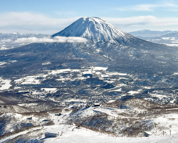
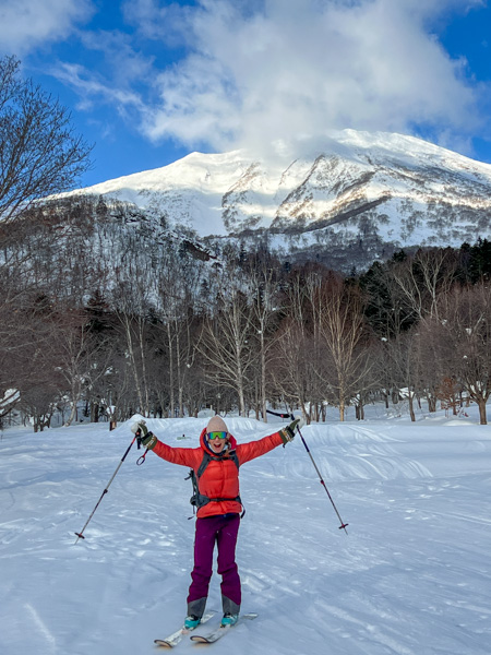
Anyone who has ever been to the Niseko region of southeast Hokkaido on a clear day will find their gaze drawn to Mount Yotei, the 6,000-foot volcano that dominates the skyline.
For ski tourers visiting the region, descending Mount Yotei is an obvious goal. While the routes may not be more technical than most moderate ski touring objectives, the unrelenting local weather may not allow a reasonable attempt. Japan is popular as a ski destination because of the continual storms that sweep across the island. Those same storms that attract skiers to the region prevent any attempts on the volcano.
Seasoned skiers in the area will attest that Yotei may not come into view except for a handful of days a season, so attempts are limited to those days when the winds and weather allow. And that’s not something you can plan for in advance.
In our case, we arrived in Hokkaido at the end of an unusually long stretch of good weather. Since the ski resorts didn’t have any powder, we set our eyes on Yotei and gave it a try.
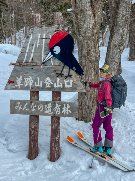
Popular maps and online resources show more than a half dozen ascent routes on the peak. We found the website Hokkaido Wilds to be extremely helpful– with maps, route descriptions, and downloadable GPX routes. After a cursory look at the options, we decided to head for the Makkari route on Yotei’s south side.
We drove to the trailhead, which was easy to locate. We were about 1000 feet above sea level, so the route to the crater rim would climb 5000 vertical feet.
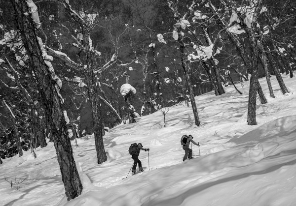
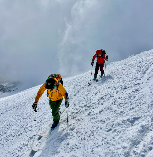
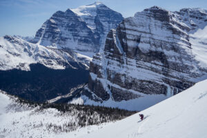
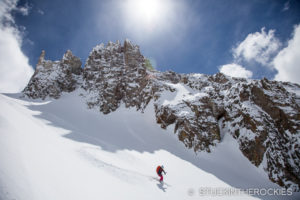
The sunny weather period brought many ski tourers to this route, so there was a well-established skin track to keep us going in the right direction. We ascended through classic Japanese birch forests that occasionally opened up into open faces and gullies that offered great skiing. As we got higher, the route began to switch back more and more.
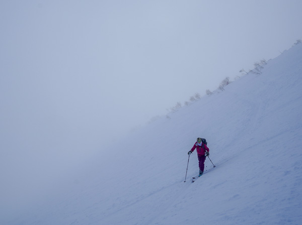
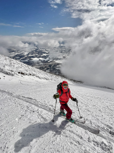
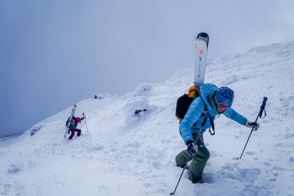
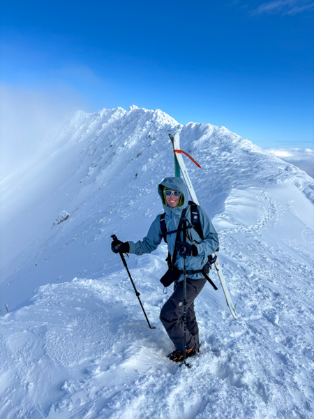
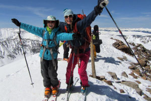
Snow conditions were favorable, and we didn’t need to use our ski crampons—though some friends advised us to bring them because sometimes the upper flanks are pretty firm. As we neared the crater rim, we found the final 300 vertical feet more easily handled by booting up, so we put our skis on our backs and hiked the homestretch to the top!
The weather was nice, but we were still in and out of the clouds. We caught a brief glimpse of the center of the crater, but moments later, the clouds moved back in, and we never saw it again. Many people recommend skiing down into the crater, but considering the late afternoon hour and the lack of visibility, we opted against that.
We had a snack, readied to ski, and began down, retracing our ascent route all the way back to the car.
In total, we needed about four hours, with stops, to get from the trailhead to the crater rim. As for the skiing, it was pretty variable. The snow up high was best. The sun and warmer temps made the snow more spring-like as we descended. The skiing was challenging but still fun. I can only imagine what it would be like with powder.
Once back at the trailhead, we drove to the small town of Makkari and stopped at the Makkari Onsen—which we highly recommend!


Leave a Reply