Reflecting on it briefly here, a few things stick out– I improved on my prior 2007 time, cutting off 1:16, with a good amount of credit due to meeting my goal of getting through aids stops faster. A crash in the early parts slowed me down for a bit, a simplified strategy for food and fluids worked better than my mixed menu last time and the weather and snow coverage weren’t an issue and might even be described as ideal.
Crash aside, things were smooth mechanically, joints held up well, blisters weren’t an issue and mentally I was way more together, with only a short bout of sleepiness that passes rather easily. By the end, my feet hurt a quite bit and the final stretch from 95 to the finish was one of the fastest stretches of the day, which is always a nice way to finish.
Put it all together and it’s hard to call it anything less than a great day out there. I finished in 11th place, in a time of 31:59. I owe a huge thank you to the crew- Christy, Tim Mutrie, Kathy Fry and Neal Beidleman. Thanks for helping me put this all together.
And that’s my report. Being so long and involved and with much of what went down out there holding significance only to me, it can be difficult to sum up the whole thing in one post. On Saturday, when it was all said and done, there were over 100 photos on my little Nikon, shot by either myself or my pacers and I thought it might be best to share some of them– to cover the day and the course from that perspective. For more of a write up, check out what Jon Maletz put together after talking with me about the day here in the Aspen Times.
Here are some highlights from Hardrock, in pictures:
7:59am (1:59) – Gunnison/Crested Butte’s Jeff Heasley nears the top of the first pass, Dives-Little Giant, about two hours after the start in Silverton, the outskirts of which can be seen in the distance below. In conversation, Heasly mentioned this was his second time here and that he opted to go entirely without support– which to him meant no crew, pacers or even drop bags. He doesn’t even wear a watch so that he can go out according to how he feels and doesn’t have to think about meeting splits or expectations. I guess it works because he finished in 41:08.
And as a reference, treeline is around 11,800 feet, which can help give you a rough estimate of the elevation in the photos.
8am (2:00)- At the pass the pace picks up a bit, traversing across the hill to the second drainage and then down to Cunningham Aid station at mile 9.2. Two big creek crossings are encountered from the start to this first aid station, both of which require you to walk through the water and serving as a welcome for things to come- wet feet are the norm through most of the course.
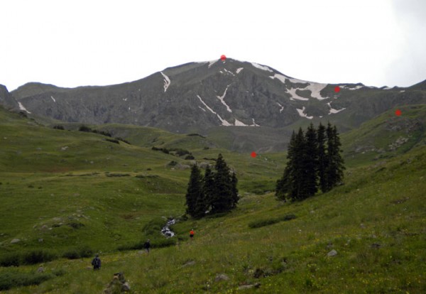
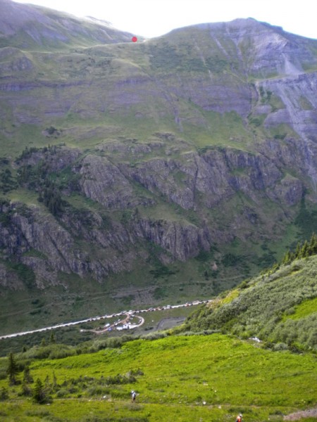 8:18am (2:18)- On the descent to Cunningham Aid, most of us were still just warming up. The aid station can be seen below and the route climbs up the hill(marked in red) in the background towards Green Mountain and Stony Pass. The pass itself is not visible in the photo.
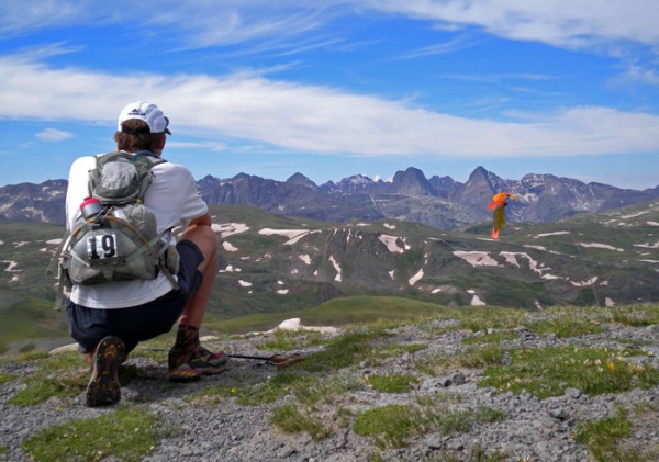 9:45am (3:45)- Kirk Apt pauses atop Stony Pass(#2), mile 12.8 to take a photo of the Weminuche Wilderness and the Grenadier Peaks. If his name sounds familiar it could be because today would be Kirk’s 15th finish here, the most any runner has completed. Kirk’s one of the legendary characters here. He won the race in ’01 and was featured in the “It’s Gonna Suck to be You” article in Outside Magazine (mentioned in previous post).
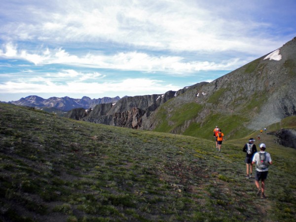
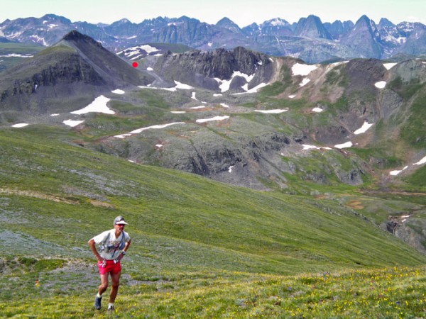 10:13am (4:13)- With Stony Pass indicated in the background, Joe Clapper makes his way up towards Pass #3, Buffalo Boy Ridge, after which a patchwork of game trails descends to the Maggie Gulch Aid station, at mile 15.3. From the aid station the trail climbs a short way to another pass between Maggie Creek and Pole Creek, appropriately named Maggie-Pole Pass, and then gradually descends to Pole Creek Aid station at mile 19.6.
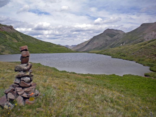 12:38pm (6:38)- Cataract-Pole Pass (#5), mile 23.5- having suffered an accidental trip and fall a few miles earlier, a bruised kneecap left me limping up to this relatively benign pass. The long six mile descent down to the Sherman Aid station at mile 28, out in the distance at the end of the valley, was needed to “walk it off.” After leaving Sherman Aid some scraped up elbows were all that remained from the fall and the concern of a DNF was rendered a memory.
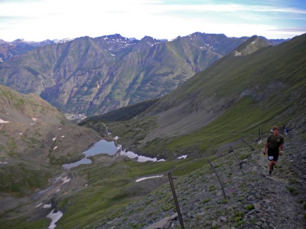
 3:33pm (9:33)- Here we are heading up towards Handies Peak after a wave of rain blew through. There were three small showers during this section of the day, only one of which required me to pull out the jacket. Mike Ehrlich, ahead in orange, was working towards his ninth finish here today– impressive. With this climb cresting the 14,000 foot elevation mark, those runners who hail from points lower often suffer a bit. The general direction of the route is indicated and the little bit of snow up near the summit was easily managed.
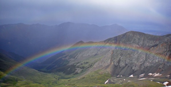
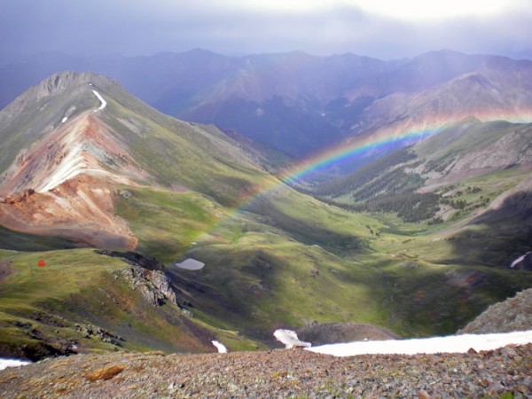 4:24pm (10:24)- From just below the Handies Peak summit you could look down in awe as a huge rainbow arced across the valley we had just ascended. The storms headed across the valley to the neighboring 14ers Sunshine and Redcloud Peaks, where they seemed to generate a bit of thunder and lightning. Thankfully it was quiet as I crested the 14,048 foot summit, the highpoint of the race. Some runners are making their way up the trail, marked on the left.
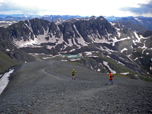 4:33pm (10:33)- Descending Handies Peak around mile 37, Bill Geist in green and Phillippe Verdier in orange start down towards Sloan Lake and to the short climb up to Grouse-American saddle, a few miles from the Grouse Aid station. A pattern developed here as Phillippe, whose his blue knee-high socks, lycra and French accent earned him the nickname “Frenchy’ (from me and the crew), took the lead on the downhill after which I regained the lead out of the aid station and/or up the following climb. He was a rocket on the downhills but crawled up the climbs and for close to 24 hours we leapfrogged in this way, that is until the last descent….
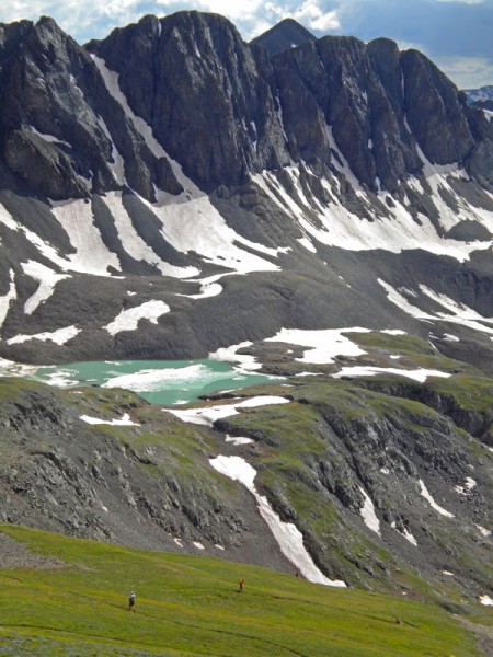 4:38pm (10:38) Sloan Lake, Frenchy bombs down the trail as I stop once again to take a photo. Maybe I could have kept up if I didn’t take some many pics.
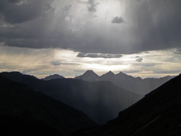 6:49pm (12:49)- Having met Tim, Christy and Kathy at the Grouse Aid station a few miles back, I made my way up towards Engineer Pass. Some more light rain blew through and another rainbow appeared. Four hours later I would see the crew again in Ouray, and as I looked from here to the west I could see Sneffels, Potosi and Teakettle Peaks in the distance. The course would travel right below these peaks as the the Governor Aid Sation is at their feet, but first we headed north(to the right out of the photo) for eight miles to Ouray and then another eight miles or so back up a different valley before we would get there. So while there are awesome views from up high in this race, passes and summits can be sobering as they also reveal the enormous scale of this whole thing.
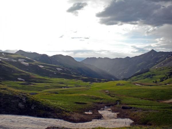 7:20pm (13:20)- Engineer Pass, mile 48- Finishing the eighth climb and with the afternoon showers dissipating, the course descends down Bear Creek in the valley below. Ouray is eight miles and over 5000 vertical feet down from here. The Engineer Aid station is down in the valley, right near treeline, and the smoke from their campfire can be seen in the photo, if you look closely. Below the aid station the Bear Creek trail becomes an exposed singletrack on a precarious shelf, high up in the narrow canyon– it was nice to cruise through it while still in daylight and see it all.
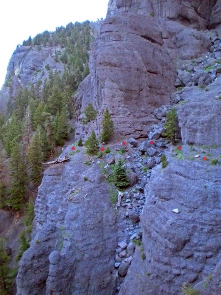 8:32pm (14:32)- Bear Creek, mile 50- this part of the trail, marked in the photo, is really something. While it may be hard to see, Frenchy just blasted past me as it goes downhill and can bee seen right above the second mark from the left. Perhaps some feel it isn’t better to cover this in the daylight as the exposure is considerable and goes along this shelf for a while and might be more manageable in the dark when you can’t see how it really looks.
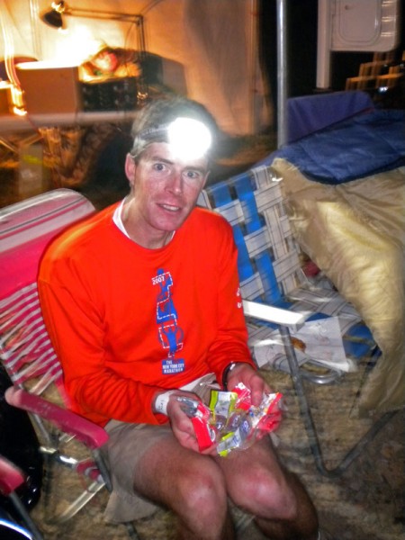 12:15am (18:15)- After reaching Ouray at the onset of darkness I put some more clothes on, grabbed my lights and took off with Kathy Fry setting the pace. This stretch, which tops out high on Virginius Pass is the biggest climb on the course and combined with the arrival of night and being in the dreaded middle miles of a 100 mile race, has a real “death march” feel to it- the attrition of the field is high around here. Fry did a great job of keeping me moving. At the Governor Basin Aid Station, mile 64.5, I took a few minutes to put down some food and realized I was hauling half a days used gu packets, seen here in the photo. While some opt for complex nutritional strategies, I prefer to keep it simple with as little solid food as possible. (photo – K. Fry)
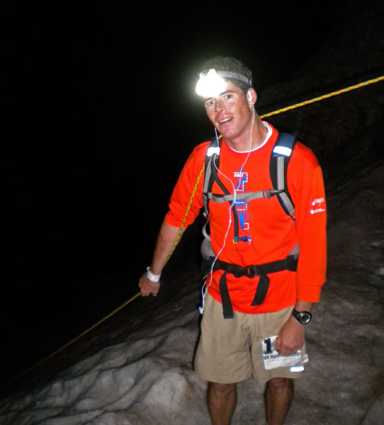 1:50am (19:50) Virginius Pass/Kroger’s Canteen – Pass #9- At two in the morning, after ascending steep snow which was thankfully aided by a fixed rope, we arrived at the top of the biggest climb of the course, ~5500 vertical feet from the town of Ouray, 11 miles below, to an elevation of 13,100 at Virginius Pass. Kathy and I took a seat for a few minutes while the aid station volunteers offered their assistance. Being near the 15th person to reach this remote spot, the volunteers somehow all still looked at us with bewilderment and after a brief Q&A as to what we had on our ipods, we started down towards Telluride. We don’t know what kind of music they were into, but judging from their expressions when we named Beyonce(Fry) and old rap, we didn’t share similar tastes. Despite the obvious differences we were still greatful for their presence here, at what is the most remote aid station on the course. Later, on the descent, Frenchy came flying by. (photo- K. Fry)
For a visual of how the Virginius climb looks by day, check out this YouTube clip. I’m sure Kathy would agree, it’s even more interesting at one in the morning–
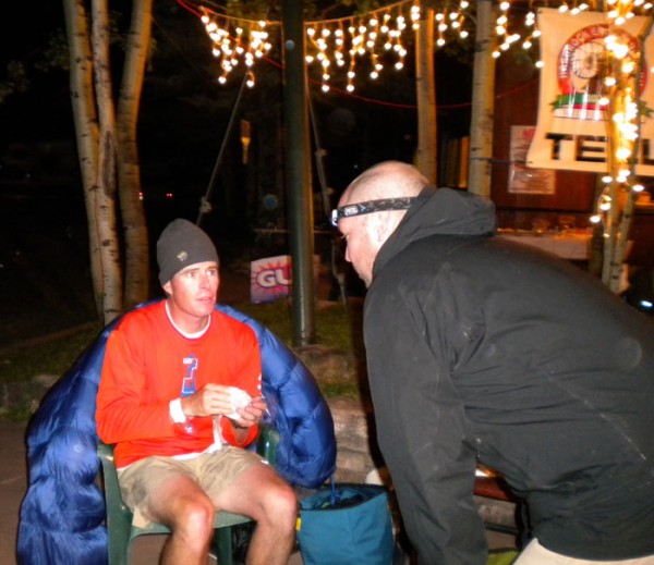 3:15am (21:15)- Telluride, mile 73- Being this deep into the race at this hour of the night but with still a marathon distance to go and four climbs remaining, Tim Mutrie knows pretty close to exactly what is needed. The mental fatigue here could be comparable or actually exceed the physical fatique and with the approaching dawn, some serious hurdles could present themselves. Internally, the wrong type of food could wreak havoc and too long of a stop allows for a shivering chill to set in. Through the years, Christy, Tim and I have together learned that there’s a fine line between an overbearing crew too eager to help and a less in-your-face team that still manages to cover all the bases and keep things moving quickly. I think we’ve got it pretty well figured out. Thanks again to the crew. (photo- K. Fry)
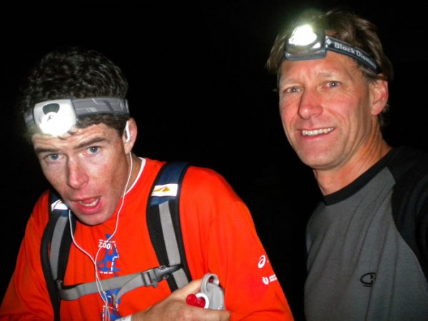 4:56am (22:56)- After making a cameo appearance in Ouray, Neal Beidleman offered to come along for the stretch from Telluride to Chapman. After Neal predictably rejected my plea to lie down in the grass to sleep for a few minutes, I put down two double caffeinated gus (espresso love), to try to get me to daybreak. Neal got a kick out of the difficulty I had putting them back and thought it would make for a good pic. I think I had near 40 gus when it was all over. When this race was conceived in the early 90’s Neal paced his friend Paul Fuller for 50+ miles and has been thinking about getting here one day himself. Neal ran a couple of the inaugural Wasatch Front 100 milers and three decades later still holds a spot high on the all time fastest finishes list. (photo- N. Beidleman)
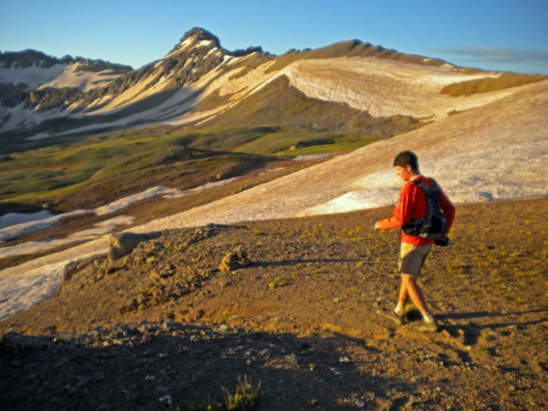 6:20am (24:20) – At the Wasatch Saddle, Oscars Pass is just off to the right. Neal was right, as soon as the sun hit the peaks around us, the urge to sleep disappeared. Funny how that works. (photo- N. Beidleman)
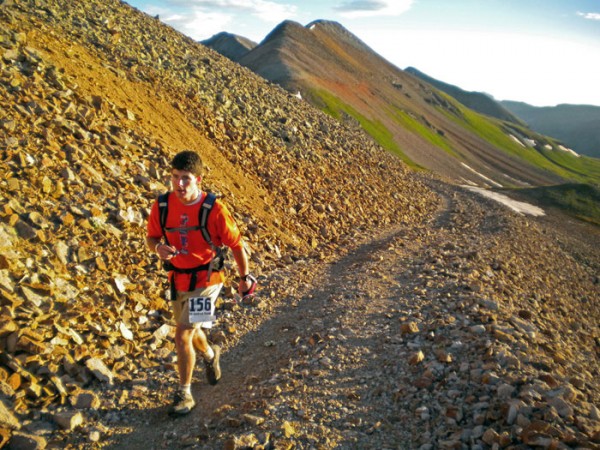 6:25am (24:25)- Marching on to Oscars Pass (photo- N. Beidleman)
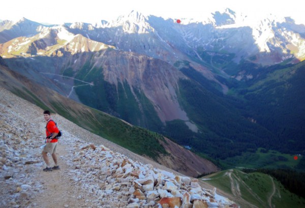 6:35am (24:35) Descending Oscars Pass, mile 79, the big climb out of Telluride is done and the next one, Grant-Swamp Pass, is marked out in the distance and it’s another biggie. First we had to descend the nasty old mining road to the Chapman Aid Station, at mile 82, marked in red down in the valley. You can see the tent. The road down to it is visible as well. If you haven’t blown out your quads by now this descent all but ensures you will, unless of course you’re Frenchy, who somehow came zipping by as I could only manage a fast walk. (photo- N. Beidleman)
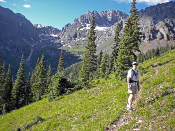 8:15am (26:15)- Out of Chapman and with Christy alongside, we passed Frenchy once again, and made our way up to Grant-Swamp Pass, at the saddle in the background. (photo- C. Sauer)
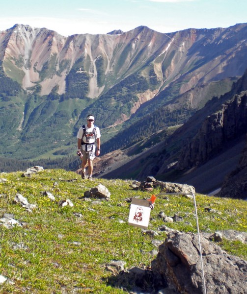 9am (27:00)- Part way up to the pass and following the route flags, you can see the switchbacks of Oscars Pass cutting down the mountain behind. It’s a nasty one. (photo C. Sauer)
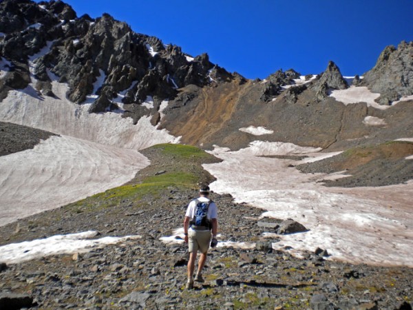 9:05am (27:05)- Not much here that falls in the ‘well built trail’ category, the route goes up the lite brown colored rock to the saddle, much of it on ground so loose that your steps are lost to the gravel and sand sliding down the hill under you foot. It’s pretty tiring this late in the game. (photo C. Sauer)
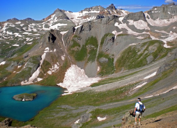 9:27am (27:27) – Grant/Swamp Pass, mile 85- With only two smaller climbs remaining before the homestretch, the descent down into Ice Lakes Basin feels good. Island Lake is below. Apart from the now familiar and demoralizing “Frenchy fly-by,” things were going pretty well. Next stop, KT Aid station at mile 89.(photo C. Sauer)
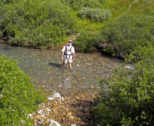 10:30am (28:30) – South Fork Mineral Creek, mile 89.5- Christy and I just departed KT and were in one of the last full creek crossings, which felt so good to my swollen feet I paused in it for a moment. Through the race I never changed shoes but did put change my socks and put vaseline on my feet three separate times. I think the vaseline might be the single biggest step you can take to stave off blisters, of which I only had one little teeny one when this was all over with. (photo C. Sauer)
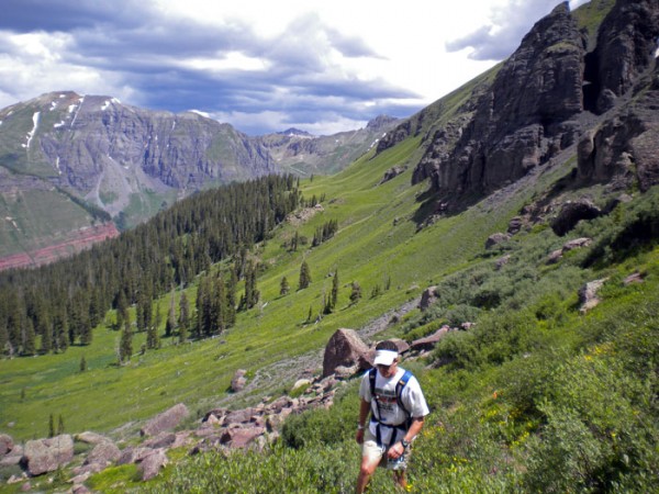 11:25am (29:25) – Porcupine/Cataract Saddle – Pass #12- In the background is Ice Lakes Basin, and to the left above the red cliffs is the Kamm traverse, from where we just came. At this point we’ve left Frenchy in the dust and are beginning to sense the homestretch. (photo C. Sauer)
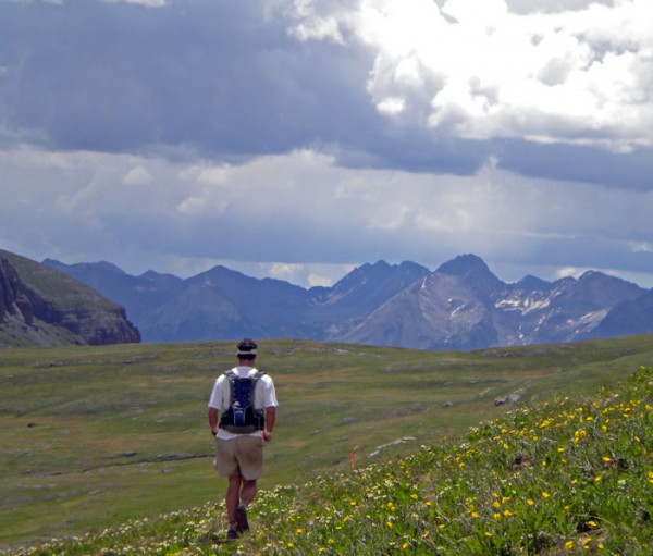 11:45am (29:45) – Lime Creek, mile 92- Off in the distance you can see the Grenadier Peaks, the same mountains seen in a photo earlier but from a much different perspective, which serves to remind you of how much ground is covered out here. After crossing this meadow we climb again up to the left, after which we descend to Putnam Aid Station at mile 94.5. From Putnam it’s mostly downhill to the finish, which can be one of the fastest sections of the day because no matter how tired you may have felt earlier, there’s always something left in the tank when you get the finish in your sights. Christy led me down so quickly that for the first time in nearly 24 hours, Frenchy didn’t pass me on the descent and we actually managed to finish in front of him. Later he said that the last few climbs did him in. A great effort none the less to Phillippe Verdier, finishing as the first non-US runner, in 32:15 and 12th place. While I may portray the back and forth as being pretty competitive, it was on the most friendly of terms while we were out there and his downhill skills were something to respect. Good job Phillippe. (photo C. Sauer)
And that was the race as far as it went down around me. It was fun.
Having since thought about it in the week or so since it all wrapped up, I’ve figured out how to be faster. Next year the camera stays at home.




14 Comments
Leave your reply.