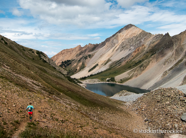
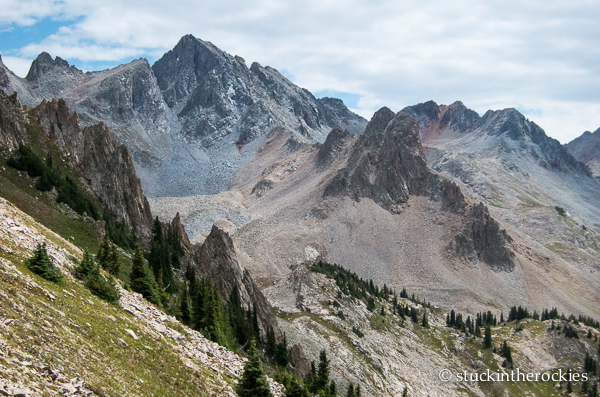
Descending from Capitol Pass towards Capitol Lake and Mount Daly. We went up around the backside of Mount Daly as it’s seen in this photo.
We pulled off a fairly large adventure run around Snowmass, Capitol, and Daly last weekend, a linkup of trails we refer to as the Superloop. We frequent a good number of local trailrunning loops in the range of 18-26 miles, and we thought this longer loop fell into its own category, hence the nickname. Sean, Neal, and I ran this last year with a slightly different finish, and Christy– who hates missing out on anything– wanted to see it for herself.

The map. Click to enlarge.
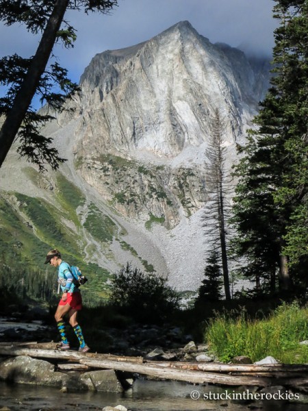
Crossing the bridge at the mouth of Snowmass Lake. Nice socks.
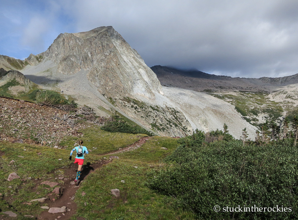
Heading up to Trailrider Pass. Snowmass Mountain is in the clouds behind.
Here’s how we did it (get ready for a lot of directions): From the Snowmass Creek trailhead, run up to Snowmass Lake and then up to Trail Rider Pass. Descend the pass as though you’re running the Four Pass Loop, and about halfway down to the valley, follow the right fork that goes to Geneva Lake. Take the trail around the lake. Just beyond where it leaves the lake and starts down towards Lead King Basin, look for a small trail to the right marked with an equally small cairn. That’s the start of the Meadow Mountain Traverse. It’s probably less than a minute down the trail from the lake and is easy to miss.
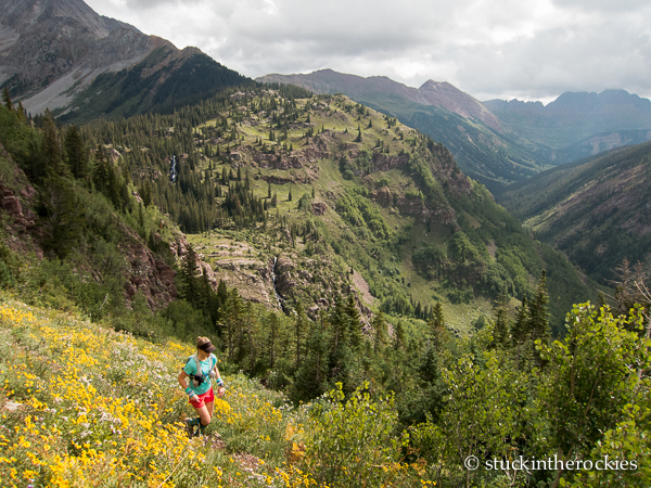
Christy on the Meadow Mountain Traverse. Fravert Basin and the popular Four Pass Loop go up the valley behind.
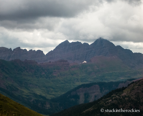
The backside of the Maroon Bells. It’s been a stormy August. Thankfully we only got rain once, near the end.
Crossing from the Meadow Mountain Traverse towards the trail up to Silver Creek Pass, which is out ahead.
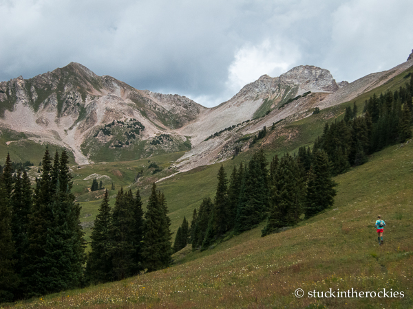
Take this trail until it ends below the south side of Meadow Mountain (marked with a cairn and stick), and then go cross-country up the ridge to the west. A game trail will appear on the ridge that continues north towards Silver Creek Pass, which you can see in the distance. Follow faint game trails until you find the more prominent Silver Creek Pass trail and head up . Take some time up top to admire the views. It’s a super cool perspective of the mountains, particularly Capitol Peak.
The view from Silver Creek Pass. See the ski line?
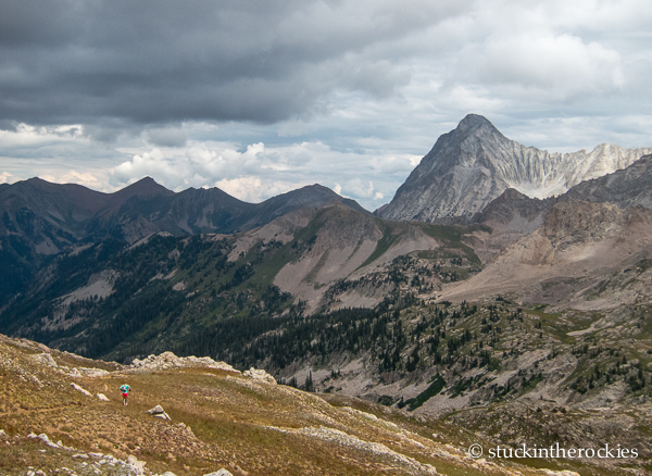
Christy heads down the East Avalanche Creek Valley from Silver Creek Pass. Capitol Peak is out there, and Capitol Pass is the saddle to its left.
Follow the trail down through the East Avalanche Creek Valley as it winds around and ultimately heads towards a minor pass and the main fork of Avalanche Creek. It’s a convoluted, faint trail at times marked with cairns– bring a map. Get through this remote section, descend to Avalanche Creek, and then climb up steeply (1,500 vertical) towards Capitol Pass.
Some East Avalanche Creek mountain scenery (no runner pictured).
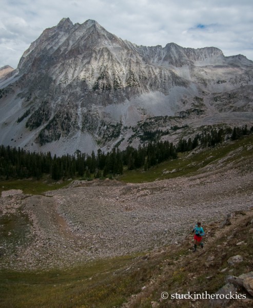
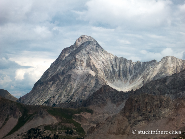
Capitol Peak is quite the mountain, particularly from this angle. Here Christy is seen descending to the Avalanche Creek Trail.
There are two options at this point– Daly Pass to Moon Lake or the West Snowmass Creek Trail. We decided against the Daly Pass/Moon Lake finish because the lack of a trail makes it a tough way to end the day. Instead we went 3 miles down the Capitol Creek Trail and connected with the West Snowmass Trail. We hiked up this pretty trail to the Haystack/Daly Saddle, and then followed it down the other side, and all the way back to the car.
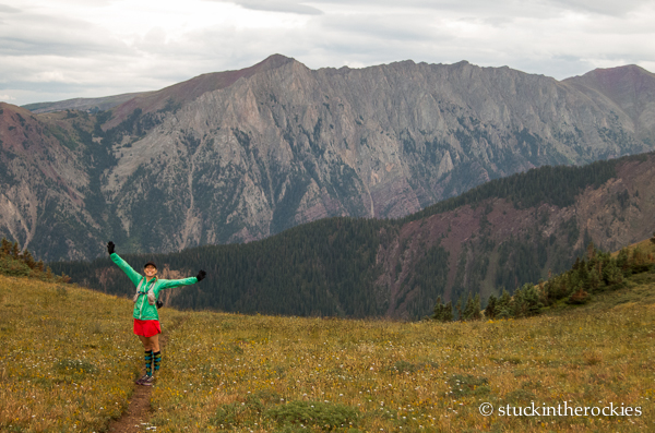
Bring on the homestretch! Christy at the pass on the West Snowmass Trail after a rainstorm forced us to hide out under some trees. The backside of Garrett Peak and Willoughby is behind.
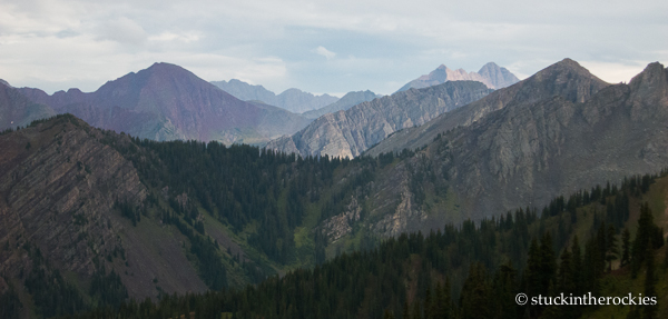
The view to the south from the Daly/Haystack saddle.
Fall is on the way.
The stats, averaged from two GPS put it at 37+ miles and 9,900 vertical feet. Not surprisingly it took all day. If you opt for the finish via Daly Pass, the mileage is closer to 31-32 miles, with about 9,000 vertical feet.
Time for a beer.


12 Comments
Leave your reply.