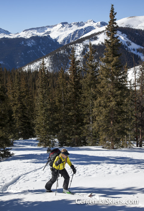
We’re three weeks into 2014, and with a stretch of beautiful weather and a good amount of snow already this season, Christy and I climbed and skied UN13811 (as in “unnamed summit that’s 13,811 feet in elevation”) last weekend. And with that, the 2014 Centennial Skiers season has started.
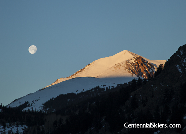
A setting moon and rising sun on Sunshine Peak, 14,001 ft.
On the subject of unnamed peaks, there are nearly seven hundred 13,000 foot summits in Colorado, and quite a few of them have never been given official names. Since a mountain without an official name still needs to be identifiable, they are often given the initials “UN” for unnamed, or “PT” for point, followed by their elevation.
Many mountains are not so lucky as to be given an official name. The high, historic peaks, the local mountains, the interesting summits– they all get named on a map, but many others do not, and the further down the list in elevation you go, the more common it is to be unnamed.
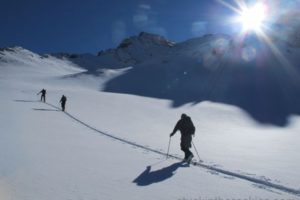
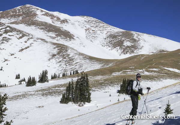
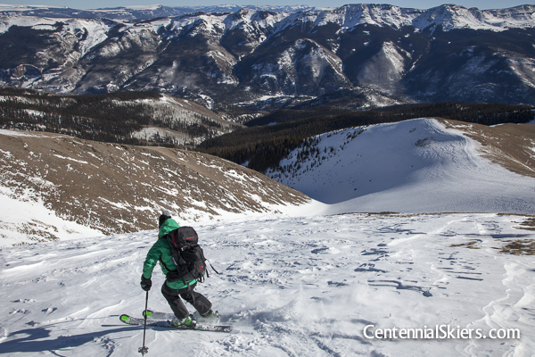
Cresting treeline after skinning through the woods for a couple of hours revealed Half Peak, another Centennial, out in the distance.
The 14ers Sunshine (left) and Redcloud (right) to our west.
Some “UN” summits are named by climbers or area locals, but may never be identified officially as such on a map. Huerfano, Phoenix, Lackawanna, and Thunder are instances I know of where people are in general agreement as to what mountain they’re talking about, but yet on a map they remain identifiable only by elevation. Some people petition successfully to name “UN” summits. Not long ago, two unnamed Centennials that were identified in guidebooks as “North Carbonate” and “Kat Carson” were finally granted official names. Interestingly though, they weren’t actually given those names, and they’re now known respectively as Cronin Peak and Columbia Point (for good reasons that are a discussion for another time).
Still others remain unnamed even by the locals. And that’s the case with UN13811.
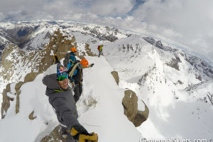
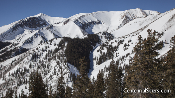
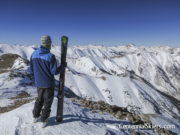
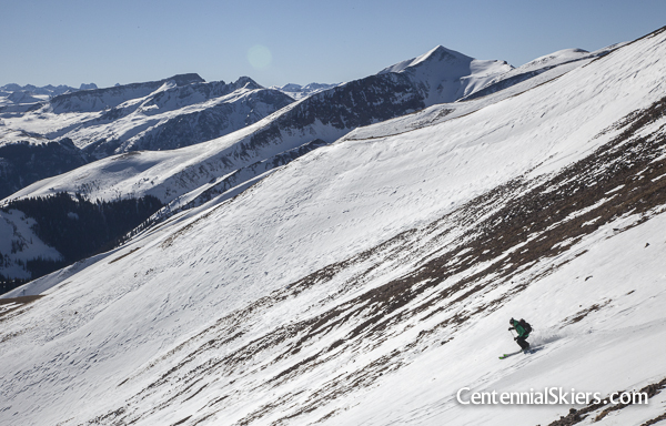
Approaching the wind scoured UN13811. We skied the ridge off the summit to the right, and the south facing basin below it.
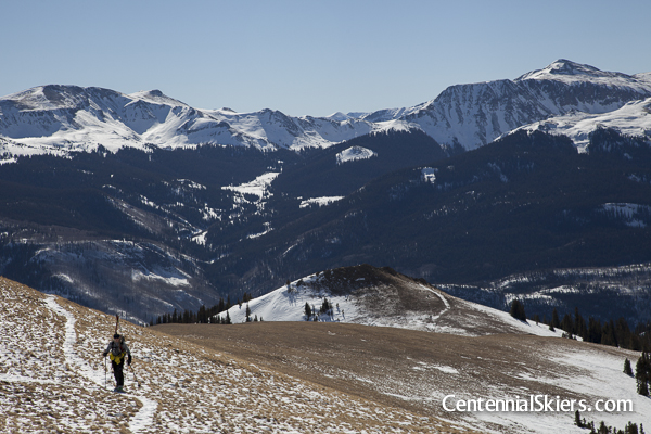
Looking back down the trail above treeline. On a side note, the trail we were using here is part of the San Juan Solstice 50 Miler course– the beginning of the long descent to Williams Aid Station.
The early winter months don’t often provide the greatest ski conditions on the high peaks. But the weather can be nice at times and there is often enough snow to piece together summit ski descents. It isn’t our goal to ski the Centennials by unimaginative, wind-crusted ridges, but in the interest of getting up high on a beautiful January weekend, Christy and I made our way down to Lake City to check out this unnamed, unloved summit.
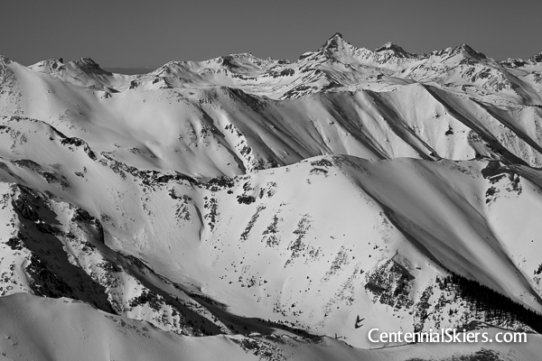
On the summit looking out to the vast sea of San Juan peaks. There’s a lot more snow out there than there was this time last year or the year before.
UN13811 is located along the ridge that goes east from the 14er Redcloud Peak. This Centennial has a dramatic north side and a mellow, grassy south side. Being January, avalanche issues were present, plus the steep faces weren’t in skiable condition yet, so we opted for the latter, the mellow angled south side of UN13811.
An artsy moment, with a rather snowy looking Wetterhorn Peak in the distance.
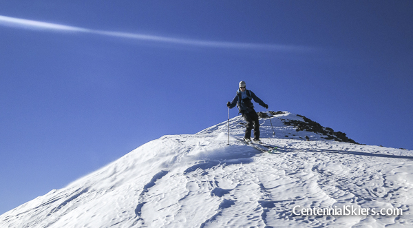
Skiing the wind scoured ridge off the summit, standard conditions for a high peak in early winter.
After consulting the maps in search of a route on this lesser-known peak, we decided that a low angled, broad, forested ridge from the south would be a safe ascent route. Once up past treeline, we figured the early winter prevailing winds would have likely scoured the west side of mountain of snow, allowing for avalanche-free climbing on bare ground. We also expected that same wind to move the snow along east and south ridges and faces, which would hopefully lead down to some snow-filled gullies. It would be a far cry from the plastered peaks we skied last spring, but we kept it in perspective, acknowledging it was a really good ski day for the date.
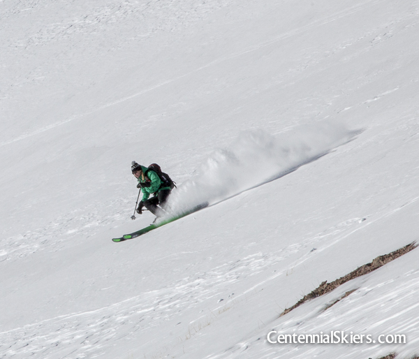
Once off the top the snow was surprisingly good. Dry and consistent.
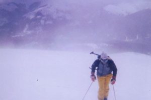
January is always thin. Ski lines are interspersed with wind scoured sections. But we weren’t complaining. It was a beautiful day.
And that’s what we found. Bare west faces, loaded east faces, sastrugi covered ridges– predictable January conditions up high. We caught views of peaks that remain to be skied– Half Peak, UN13832, Rio Grande Pyramid, Phoenix, and Stewart. Some of them looked good. Others, near Creede, still need snow. But that was partly the point, to clean out the cobwebs, get up high, and see what was going on. Besides, with Dav unable to join us here, we’ll just have to come back as a group and ski the steep north side too.
We followed the visible snow into the trees and back to our uptrack. We skied all the way down to 9,600 feet without taking our skis off.
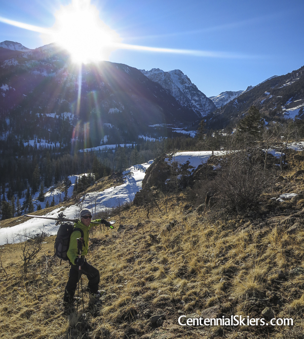
Down in the valley we had to do some XC hiking to finish off the day under the low afternoon sun.
So we’re crossing our fingers, hoping this winter continues on track. We have big plans this spring.
And if you’re in Boulder Thursday, come by Neptune Mountaineering at 8pm for a slideshow with Christy and I on the project, what we’ve done, and what’s still yet to come.