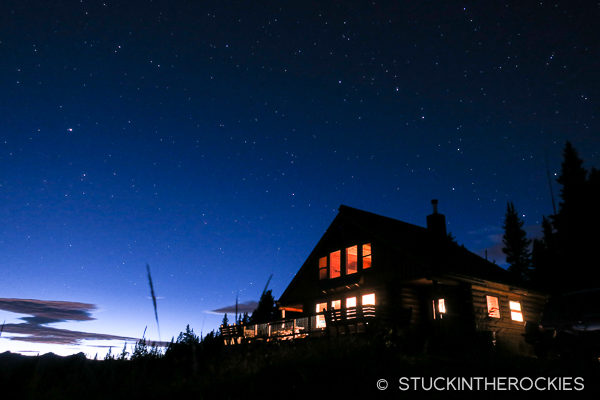
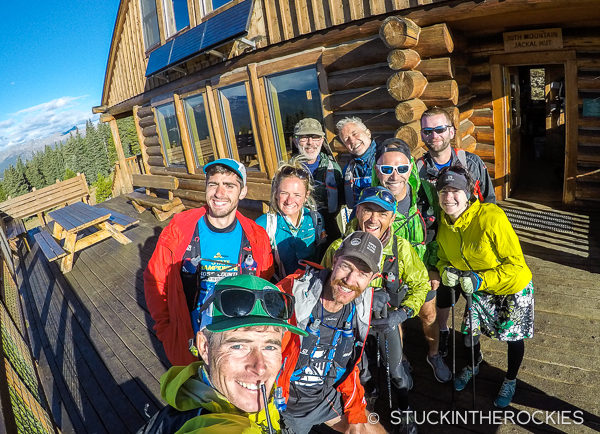
Evening at the Jackal Hut, the fourth night of the Hut Run Hut.
A few years back our good friend Rickey Gates organized a guided, multi-day trail running adventure through the 10th Mountain Hut System. He called it the Hut Run Hut. The idea was to lead a group of adventurous trail runners along a roughly 100 mile route between Aspen and Vail. The trip was spread out over 6 days, and visited five different huts along the way.
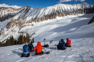
Obviously some additional support is needed for a trip like this. Keeping the group fed and running is a monumental task so having a chef handle the meals is a great help. It’s also useful to have someone assist with the logistics of moving gear and support vehicles as well as managing the various hut tasks. As for the actual time on the trail, it’s good to have a second trail guide to keep runners on the route and moving on schedule. And for the most recent Hut Run Hut tour, Rickey asked if I could fill that role.
Of course I said yes.
Day 2, on Mount Yeckel, above Margy’s Hut.
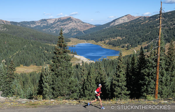
Above Ivanhoe Lake after leaving Betty Bear Hut.
Descending down towards Turquoise Lake.
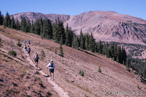
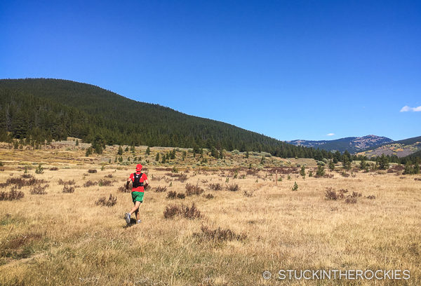
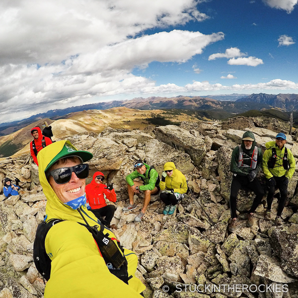
On the route to the 10th Mountain Division Hut, which at seven and a half hours was the longest leg of the Hut Run Hut route.
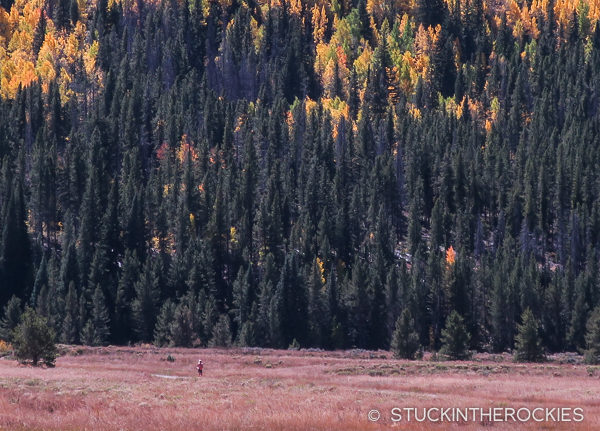
It was a truly unique way to explore this part of Colorado’s Central Rockies. The route starts in Aspen and heads north, following dirt trails, jeep roads, ridge lines, and single track, with some periodic bushwhacking and wet feet (if you’re not careful). It crosses through National Forests, wilderness areas, over passes, by ski areas, alpine lakes, and memorials— all the while staying at high mountain huts. It was such a cool experience that upon my return I found myself telling anyone who would listen that they should look into this trip next year.
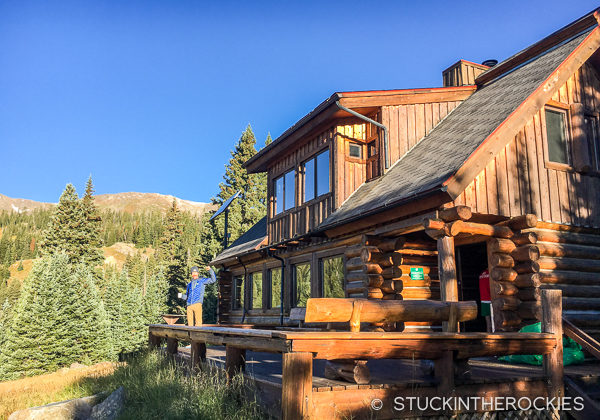
Coffee in hand, Rickey gives a strongarm of approval on the morning of the 4th day, where we all ran to Tennessee Pass, Camp Hale, and the Jackal Hut.
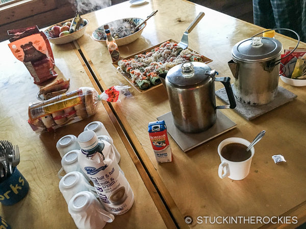
Breakfast never disappointed.
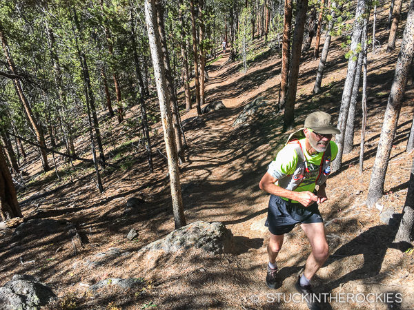
On a section of the Colorado Trail.
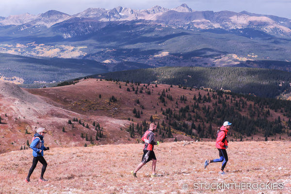
Cruising some high meadows below Tennessee Pass.
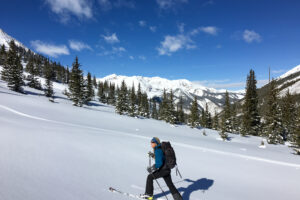
That’s not to say it was easy. Most of the days required about 20 miles of trail running or hiking to get to the next hut, and at the end of the six days we had climbed about 20,000 feet. The usual elevation we were traveling at each day was between 9,000 and 11,500 feet.
Running across the flats of Camp Hale, where we broke for lunch on the fourth day.
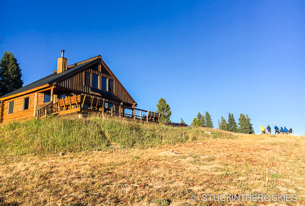
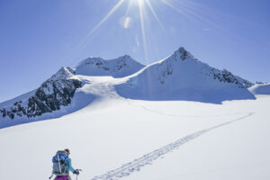
We were up at Jackal Hut, the highest hut in the system, by late afternoon.
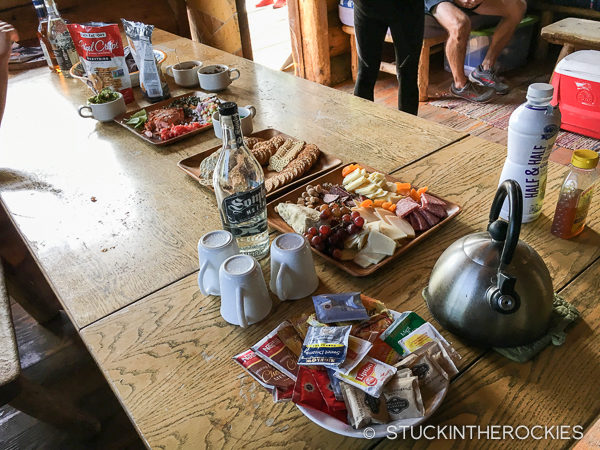
The post-run spread was always a hit with the group.
Morning views of Mount Elbert.
And it was time to go, again.
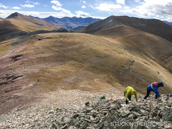
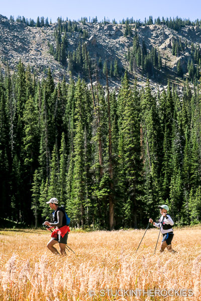
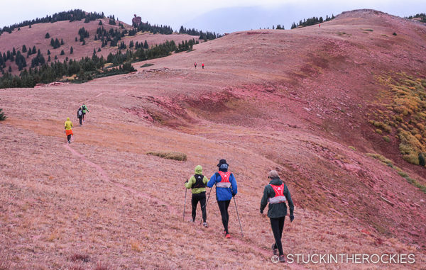
On Elk Mountain Ridge for the fifth day which involved more high alpine hiking than fast running.
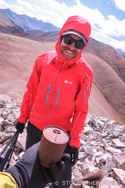
Rickey found an unopened can of something up there. Dare we open it?
Rickey recently wrapped up an enormous running project he called Transamericana. He traveled on foot, unsupported, from coast to coast over 153 days. You can read more about it here. It made for some interesting, insightful, funny, and on occasion, scary, tales of the adventure that he shared with group along the way.
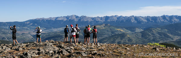
The gang on top of Sugarloaf Peak.
Cruising the ridge with Mount of the Holy Cross in the background.
Almost to Shrine Mountain (out in the distance).
Atop Shrine Mountain before descending to the namesake cabins for our final evening of the adventure.
Sparing the specific long form details of the route, we went from Aspen to Margy’s Hut, Betty Bear Hut, the 10th Mountain Division Hut, Jackal Hut, and the Shrine Mountain Inn. From the Shrine Mountain Inn we actually descended to the town of Red Cliff rather than Vail. The individual day’s stats as my watch recorded them are as follows:
Day 1 – Aspen to Margy’s Hut | 18.66 miles | +5320’ -1931’
Day 2 – Margy’s Hut to Betty Bear Hut | 19.58 miles | +3811’ -4019’
Day 3 – Betty Bear Hut to 10th Mtn Division Hut | 18.19 miles | +4014’ -3743’
Day 4 – 10th Mtn Division Hut to Jackal Hut | 18.01 miles | +2954’ -2677′
Day 5 – Jackal Hut to Shrine Mtn Inn | 12.03 miles | +2931’ -3394’
Day 6 – Shrine Mtn Inn to Red Cliff | 9.39 miles | +299’ -2862’
Total
95.86 miles +19329 ft. gain / -18626 loss
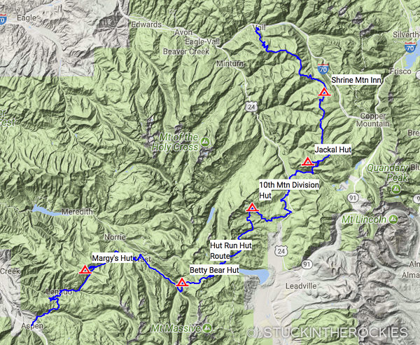
A map of the route.
Each day had a slightly different feel, as did each night since all of the huts have their own personalities. Some days had more running and others had more hiking. There were fast stretches on the Colorado Trail followed by hiking above treeline high on the divide. Sometimes we were cruising forests of Lodgepole Pine, high alpine meadows, or slogging up a trail-less meadow to reach the hut. It never felt routine and the day always ended with drinks, appetizers, and a five-star dinner at a new hut. It was hard to beat. As testimony to how cool of a trip this was, three of the guests in the group were actually running the route for their second time.
I could go on, but the fact is the Hut Run Hut is an awesome Colorado adventure— challenging, beautiful, and fun all at the same time.
For more info, go to the Hut Run Hut website here.


2 Comments
Leave your reply.