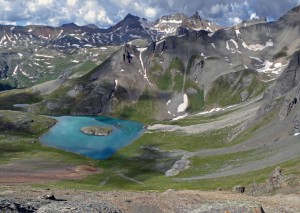
Island Lake and Ice Lakes Basin – just another one of the awesome views out there on the course. Click any photo to enlarge.
The 2010 Hardrock 100 is done and now, a week later, I’m still trying to put it all together.
In the days that followed, as I embraced my “recovery”, mostly in the form of sitting on the couch and watching repeats of the days Tour de France leg, I fought the urge to procrastinate and attempted to post something about the event. But as I sat with my laptop open, I just couldn’t seem to put anything into words. Now a week later, still feeling challenged with the task of reconstructing the day in my head, I’ve come to realize there was so much packed into the 30+hour effort that I can’t do it justice in a simple blog post. The memories I have from the day range from visual images of steep trails, creek crossings, and distant mountains that moved position with every pass I gained, to faintly recalled bits of conversations with pacers, fellow racers, aid station volunteers or myself in my own head(which comprise the majority), to broader moments like the sunset on Engineer Pass, Handies Peak at midnight, dawn in Pole Creek, and more acute imagery like the sickly elk we came upon at dawn, the passed out runner above Maggie, and the finish and kiss of the rock– it is for the third time now, the most unique experience I’ve been a part of. So for that reason, I can only really sum it up briefly, and then hope the photos fill in the gaps.
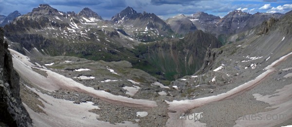
The expansive view forward from Virginius Pass. The route to Ouray heads right down the snow to the pinch leading to the valley below. Click any photo to enlarge.
In sum, having completed the loop course twice now in the counter-clockwise direction, today was my first go the other way. Starting a little faster than in years past, I still kept it pretty mellow, passing through the first aid station, KT, in 28th position, and from there I slowly moved forward. I generally don’t concern myself with overall place during these races, but in hindsight it can be useful to track how you fared when compared to others around you. That said, I left Telluride in 19th or so, and just ahead of a thunderstorm that came through, which would thankfully be the only weather I ever encountered. I left Ouray around 14th and, paced by Christy, we moved up six spots over the next 28 mile stretch, which included the traverse of 14,000 foot Handies Peak, to Sherman. There, in the dreaded wee hours of the night, with tattered Hardrockers now spread out all over the San Juans and with a mentally daunting 30 miles to go, Neal tagged in as a pacer and we left in eighth, and feeling relatively good. This last 30 mile leg, thanks largely to Neal’s motivation, was completed in about nine and half hours, which for that stage of the race, is pretty good. I kissed the rock in 30 hours and 21 minutes, in 6th. And now I’m left trying to figure out how exactly it all happened.
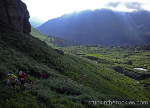
The first climb out of Silverton on the clockwise loops takes you up into Putnam Basin. When going the other way, there’s an aid station down in the trees that is a welcome sight at mile 95 but for this direction the field gets up here pretty fast and hardly needs support. John Beard, seen in red, would eventually finish in 9th and I believe that’s Bruce Grant in yellow.
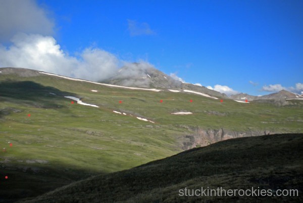
Once out of Putnam Basin the course briefly descends and then traverses Cataract Basin to the next minor pass, marked at the far right, and then descends to the KT aid station at mile 11.
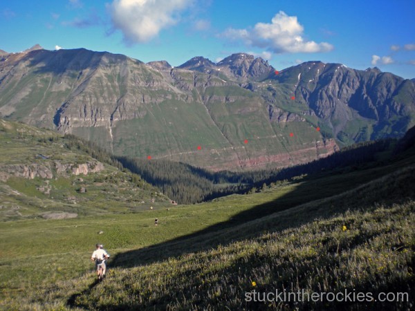
Runners descend to the KT aid station after which they head out on the Kamm Traverse(KT), following an old game trail marked in red, all the way around until it connects with the Ice Lakes Basin Trail. After a brief stretch on that trail, the course splits off again, heading up towards Island Lake and the notorious Grant/Swamp Pass, also indicated by the highest red mark.
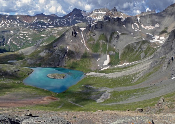
The intro photo and a sort of classic Hardrock vantage point, atop Grant/Swamp Pass with Island Lake below, about mile 15 for the CW loop.
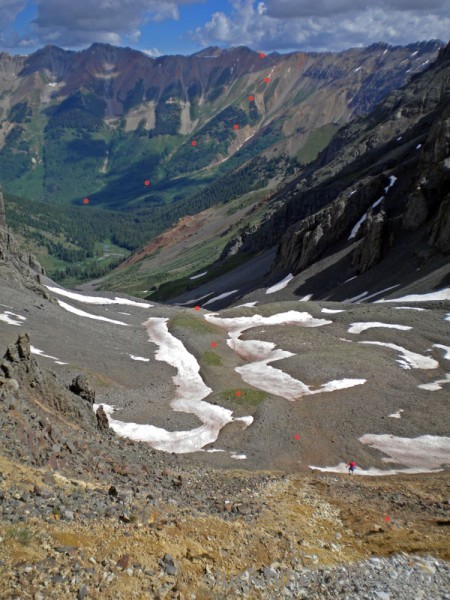
John Hallsten descends the trail-less backside of the pass. Opinions vary as to which direction is better or faster and it’s hard to say, but individually, many of the passes are tackled more easily in one direction than the other and in this case, descending to Chapman Aid Station in this direction is way easier than climbing up this scree slope at mile 85 on the CCW loop.
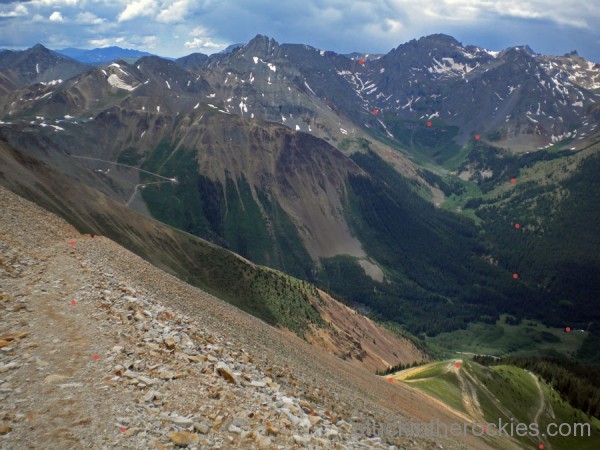
After descending Grant/Swamp to the Chapman aid station, marked by the tiny white tent down in the valley, the climb up to Oscars Pass at mile 23 or so, is a true grunt. Is it harder than descending it with sore knees the other way at mile 78? I don’t know. This stretch might be equally challenging in both directions.
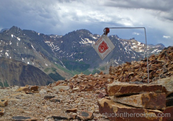
A shot of the ubiquitous course marker atop Oscars with Grant/Swamp in the background. Next up is the descent to Telluride.
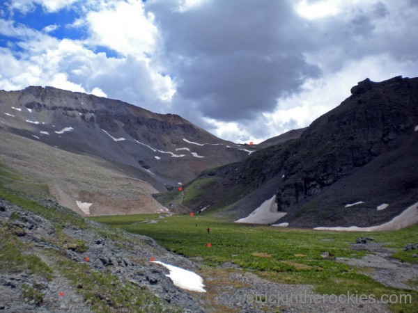
The course cruises on a good trail from the Wasatch Saddle(the marked highpoint) all the way down Bear Creek to the Telluride Aid Station in the Town Park, which, by the way, is a lot more exciting mid day today than it is when we hit it during the late night hours the other way around.
All told, the splits chart reports I spent about 45 minutes total in the 12 aid stations, and otherwise took no breaks. For the most part I carried a hand held bottle with water and a GoLite pack with a diluted sports drink, and typically finished them both by each aid station. I downed an additional bottle of Gatorade, or the like, at all the main aid stations, as well as a random cup or two of flat Coke or chicken broth, when they were available. I think I set a Gu consumption PR at somewhere around 50 packets(gross!) and hardly had a bite of whole food. Two dozen S-Caps and about 8 Advil round out the list of what I put down. I think the benefits of keeping things fairly simple were seen in my relatively solid stomach throughout the race.
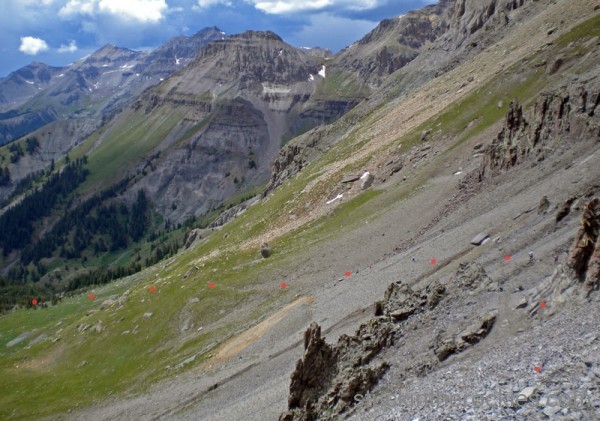
After Telluride the route heads up to Virginius Pass, as seen in this pic, with Dallas Peak in the background. A thunderstorm came in over Bear Creek and Telluride soon after we left town. Hard to see to the right side of the photo are Betsy Nye and Allen Hadley.

A panorama of the view just below Virginius. Click to enlarge. A runner can be seen above me to the left and several, including Nye and Hadley, faintly along the red markings to the right. Out in the distance Telluride ski area can be seen and Bear Creek, which we descended before here, is the valley just to its left. We’re about 32 miles in here.
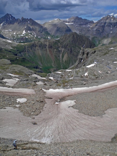
Jason Koop(blue) and John Beard(red) descend off Virginius, down towards Governor Basin and Camp Bird Mine Road. I found I enjoyed this stretch much more than when going CCW, but that could have more to do with being in the daylight here as opposed to the middle of the night the other way. Or maybe I was just feeling better. Mt Snefflles(L) and Teakettle(R) frame the backdrop.

Another panorama from below the pass, near the old mine. The pass is actually to the top left, above the snow and out of sight in the photo, and John Beard and Jason Koop head down the old mine road to the right. The San Sophia Ridge is the jagged ridgeline in the center.
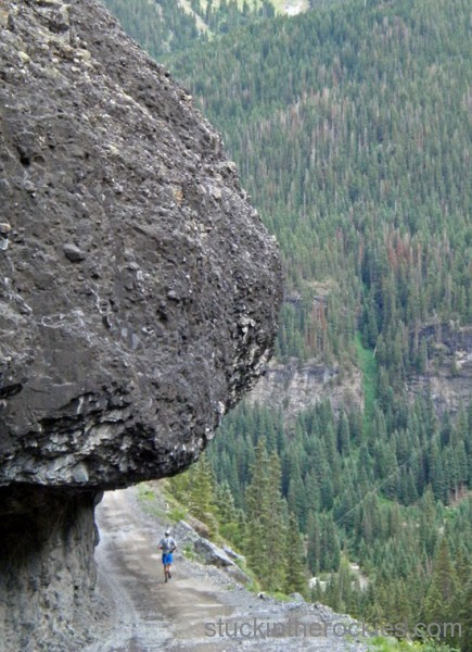
Jason Koop again, on the shelf road to Camp Bird Mine. Ouray is about 6 miles down from here and is totally cruisey this direction.
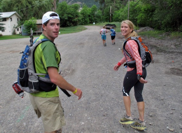
Leaving Ouray, mile 43, to head up to Engineer at about 5:40pm, Christy paces and Betsy Nye is just ahead.

The Bear Creek narrows are cool in either direction, so long as it’s light out. The poles weren’t too helpful here and I eventually put them away until later. I find the steeper the climb, the more I get out of them, and when the terrain switches from hiking to running repeatedly, they just get in the way.
New for me this year was the use of poles, which I have to say were awesome. Not so much because they made me faster, but because they spread out the uphill effort to other muscles and seemed to help preserve my legs. Poles are required gear for us going uphill in winter, which we do a lot of, so it only made sense that they would be useful to me here. Once I moved past the stigma I’ve always associated with summer tourists in Aspen using them on area trails, I was glad to have them, and I used them on the climbs of Virginius, parts of Engineer, Handies and out of Cunningham. On a related note, Black Diamond has a sleek, new ultralite trekking/running pole set for release soon and there were several pairs out on the course. The feedback was that they work great– so be on the lookout for them sometime in January.
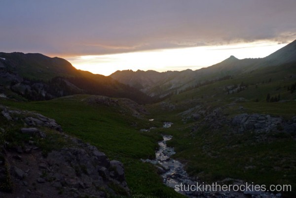
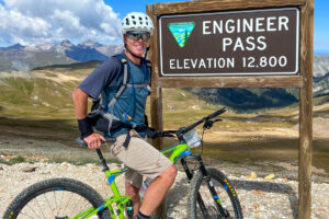
Just below Engineer Pass as the sunset, Christy took this photo of the valley we just ascended. The Engineer aid station is down at treeline in the photo. We’re around halfway through the course here.(C. Mahon photo)
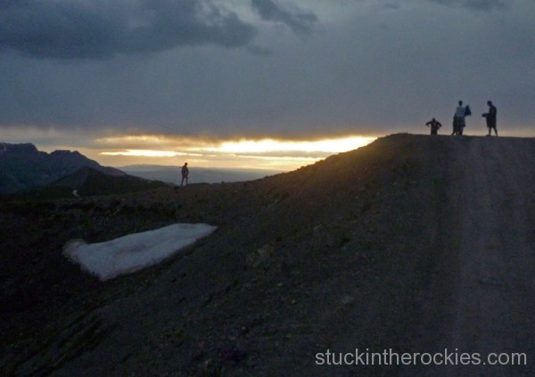
The sun has set and a small pack of us have just reached the top of the Engineer Pass Road- Roch Horton, Jason Poole and John Beard(and pacers) I believe. Lights were turned on and we headed down the jeep road to the Grouse Gulch Aid Station in the dark. (C. Mahon photo)
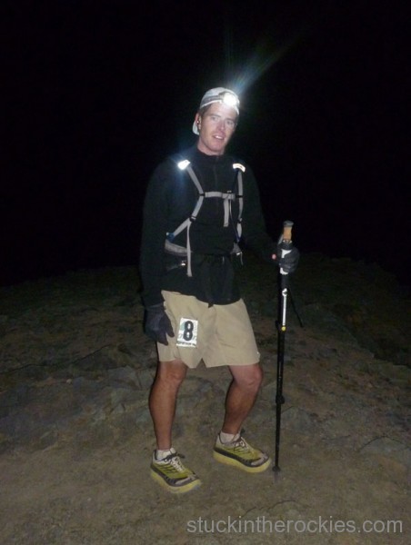
After leaving Grouse, Christy pulled me up to Handies Peak, arriving on the summit around 12:30am. We both found the poles useful here, I gave her one of mine for the finish of the uphill– aren’t I nice? I also had my Hokas on now and kept acknowledging how comfortable they were. (C. Mahon photo)
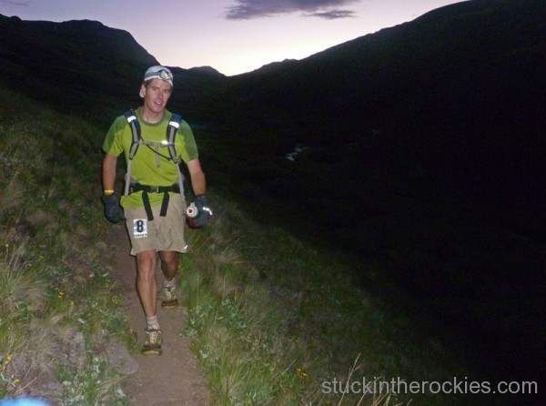
The night hours are lean on pics, and after Handies we made it to Sherman Aid Station at 2:42 am where Christy tagged out and Neal took over pacing duties. We blazed(in a relative sense) to the next stop, Pole Creek, covering the nine and a half miles in three hours. Usually the predawn stretch is the slowest for me but for some reason I never battled the urge to sleep. The shoes were awesome on trail surfaces like this, smooth-ish and downhill. Shortly after this photo we came up on a sick elk that appeared to be on her last leg, gaunt, and likely blind, she was unphased by us only a few feet away and Neal thought her days were numbered. (N.Beidleman photo)
And what people seem most curious about were my shoes. I switched to the Hoka’s at Grouse, around mile 60, and through the next section over Handies I proclaimed to Christy, no fewer than ten times, how glad I was to be in them. In hind sight I should have worn them earlier, if not for the whole day. As for feedback, I felt little to none of the typical sore knees towards the end of the race and might even go so far as to say they deserve credit for fewer days of sore and swollen joints in the days after the race. I never rolled an ankle and on the more sure-footed descents I was barreling along much faster than I could have in my other shoes, at least this far in the race. The only noticeable shortcomings were that I slipped in a few places descending Handies (on steep loose surfaces) and the off-trail-XC descents like that down from Green Mountain, were a bit clumsy and I had to be real careful with my foot placements. In the end, I still give them a big nod of approval, and when things really start to ache, they’re a godsend. Both Karl Meltzer and Diana Finkel started in them.
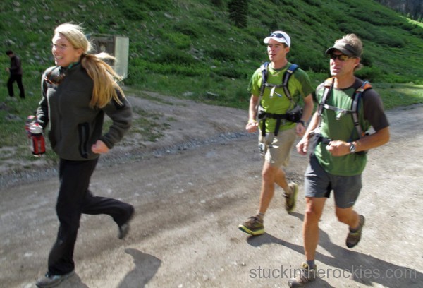
Cruising into Cunningham, mile 91.3, just a short skip over Dives/Little Giant Pass and we’re done! (T.Mutrie photo)
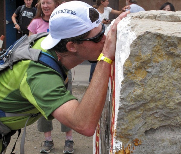
The clock doesn’t stop until you kiss the rock, in this case, 12:21:26 on Saturday. (T.Mutrie photo)
So I began this day with the acknowledgment that it would be my last Hardrock, it’s just too hard to get ready for such an undertaking so early in summer. In fact, I repeatedly reminded myself and my crew of this fact through the 30 hour epic. But the further along I got, after never really hitting much of a low point, feeling a sour stomach or going against the urge to sleep, never feeling as if it was dragging on, or bitching about being “over it” I realize I have to go back, it’s just too much fun. It’s funny how the mind works.
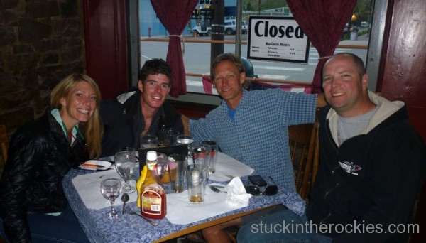
The team- Christy, myself, Neal Beidleman and Tim Mutrie. Thanks guys, I couldn’t have done it without you.




12 Comments
Leave your reply.