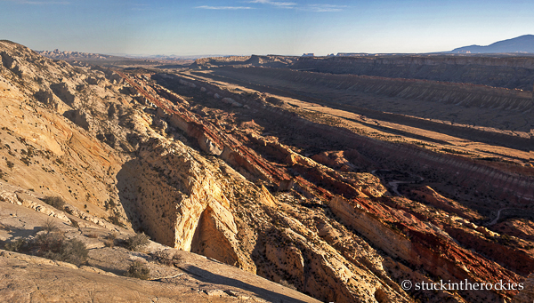
Looking north up the Waterpocket Fold in the morning. As you travel east (right) you pass through younger and younger rock strata.
The Waterpocket Fold of Capitol Reef might be best described as a bend in the earth’s crust where subsequent erosion has exposed the underlying rock strata. Whereas the layers of desert rock are normally seen in a canyon wall stacked vertically, the layers of the Fold are tilted on their side and are eroded away to varying degrees. When viewed from the air, it’s impressive. But you can also get down in it, and day-hike, bike, backpack, or just drive through the Fold, which is even better. You can literally travel farther and farther back in geologic time as you move through the area from east to west.
(You can also go forward in time by going the other way. It’s less fun though, because heading to the present, and ultimately back to work, just isn’t that great.)
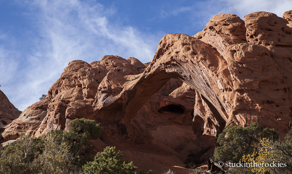
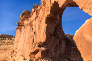
Saddle Arch, one of a half dozen arches we saw in the Wingate Sandstone on our trip.
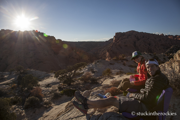
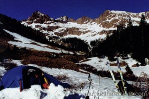
We hustled to camp high on the ridge of white Navajo Sandstone to catch the sunset.
It’s hard to cover a 100 mile long desert feature in a couple of days, so we just picked a spot we had read about and went— Upper Muley Twist Canyon. We drove south from the Park Headquarters along the Notom/Bullfrog Road, and then turned onto the the historic Burr Trail which traverses the Fold along an impressive set of switchbacks. Muley Twist Canyon leaves from there, traveling the boundary of the Wingate and Navajo Sandstone layers.
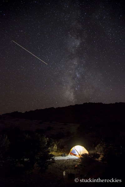
There’s hardly any light pollution (or any other varieties) this far from everything, and it makes for some pretty cool nighttime exposure shots.
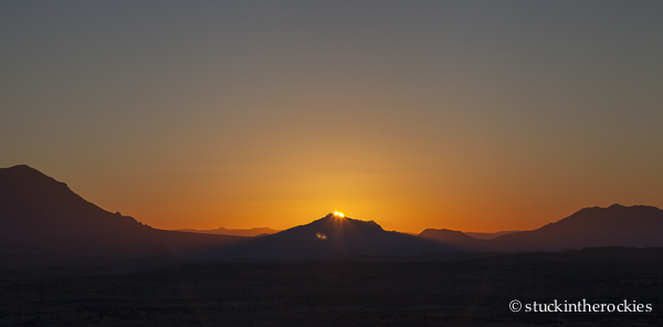
And it’s a pretty sweet spot for killer sunrise shots too. Here, the first glimmer of the sun peeks over a small summit of the Henry Mountains.
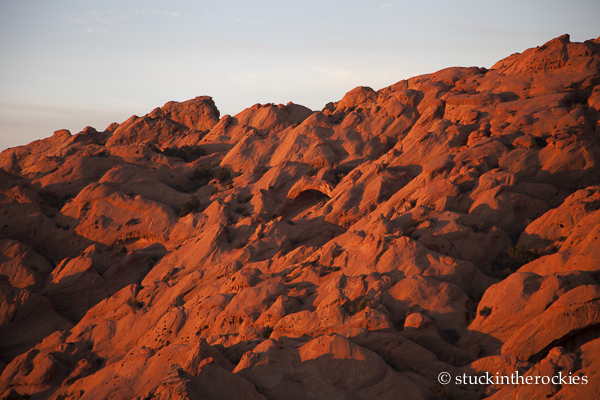
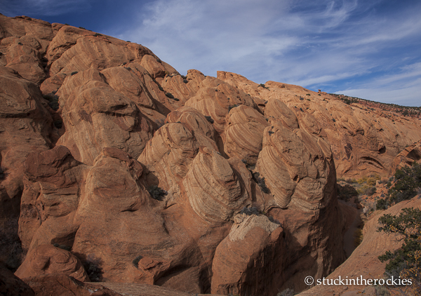
The Wingate glows in the early sun.
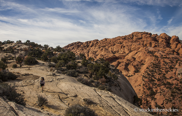
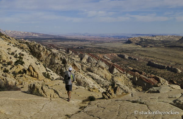
One cool thing about this lollipop route is that it allows you to spend part of the time high on the crest of the fold, and the rest of the time in the canyon itself. We opted to take on the ridge crest section first, where we could camp up high for some pretty cool sunrise and sunset views. The following day we could then descend into Muley Twist Canyon and head back to the trailhead.
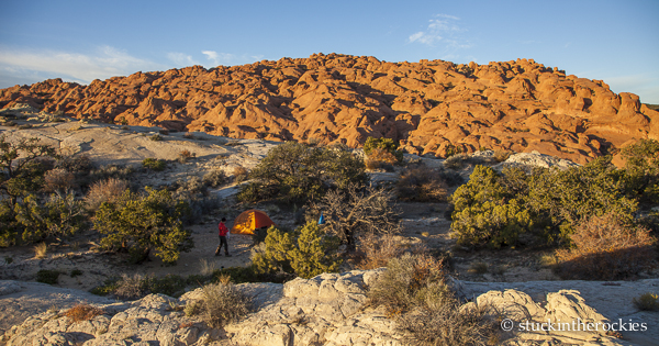
Breaking camp
We first continued north to a spot where we could descent into Muley Twist Canyon, between the white and red layers of Wingate and Navajo sandstone.
It’s a pretty incredible stretch of hiking.
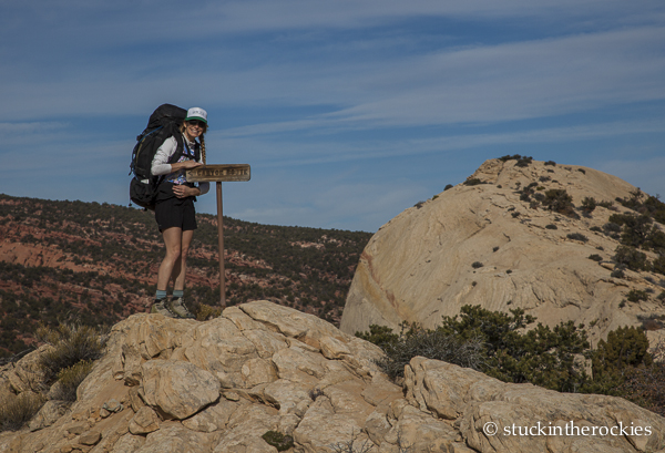
Clearly marked, the descent to Muley Twist came next.
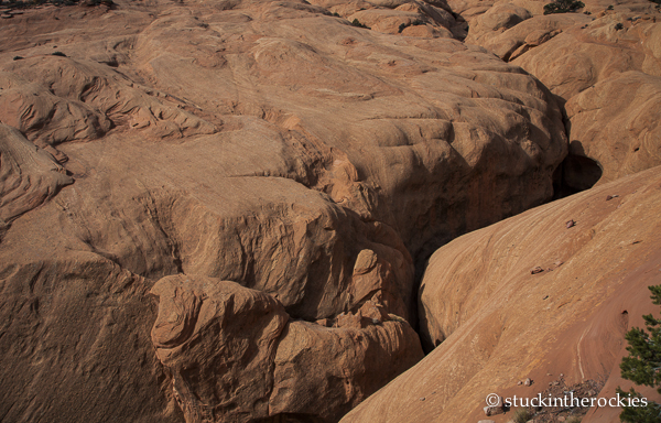
A narrow stretch of Muley Twist, too tight to walk through. We passed it on a trail above.
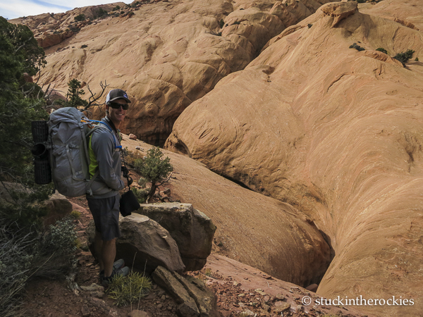
It was a cool descent of the canyon after the earlier ridge-walk.
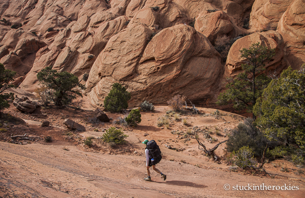
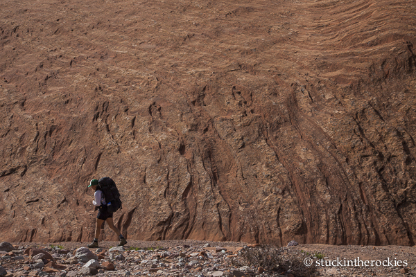
It’s some pretty interesting hiking. Unfortunately there’s no water available so you have to carry it all– about 3 gallons for the two of us for this 24-hour outing. Of course we could have lightened things abit by cutting out the excessive coffee drinking session at breakfast.
Rather sci-fi like.
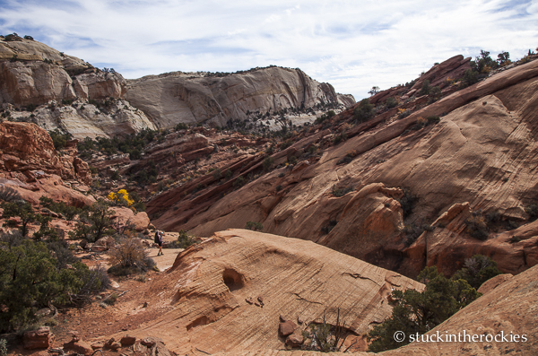
Continuing down, you can see how the canyon runs between the two distinct layers of rock. Our camp was high on the ridge to the left (Navajo layer).
Sandstone texture
It was a short stint in a big area, but afforded us a pretty cool intro to what it was all about. There’s a lot more here to come back and explore someday, but for now we’re happy with what we managed to see in Capitol Reef in just a few days time. Go check it out.


4 Comments
Leave your reply.