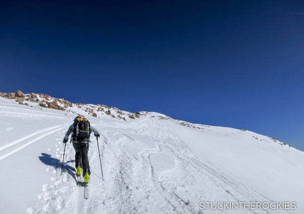
On the second climb of the day up East Ball Mountain.
The inaugural Father Dyer Postal Route ski mountaineering race took place last weekend in the mountains outside of Leadville. You might have to add this one to your calendar next season.
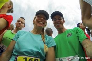
Seventeen teams of two including ourselves showed up to check out the new event which has the distinction of being the highest ski mountaineering course in North America. Topping out at 13,855 ft., on the summit of Dyer Mountain, it stood out from other popular “skimo” events that often stay primarily within ski area boundaries and may not ever involve any real ski mountaineering or actual summit ski descents.
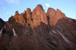
At daybreak the three high points of the course came into view– Ball Mountain, East Ball, and Dyer Mountain (from right to left).
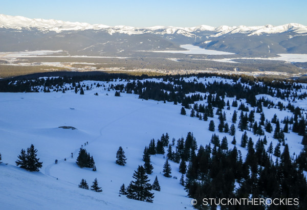
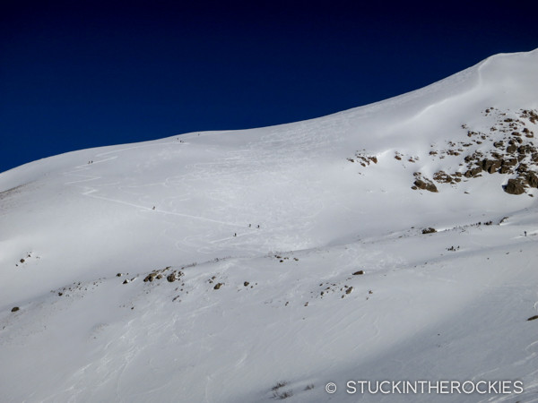
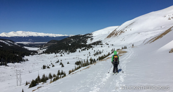
Looking back on the course while ascending the round-ish Ball Mountain, other teams can be seen in the distance.
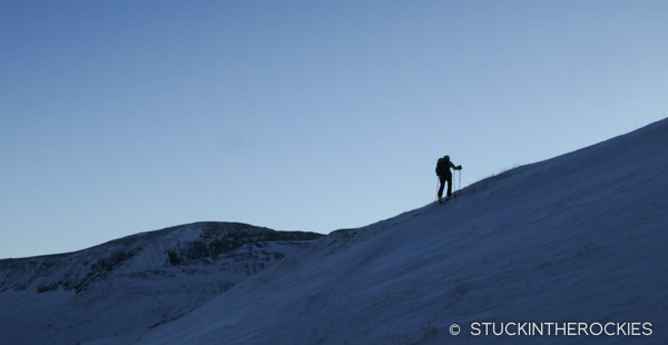
It’s a short climb up Ball Mountain, and the shade of the morning kept things quite cold.
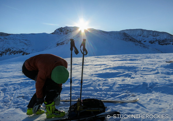
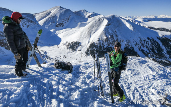
Christy transitions on top of Ball Mountain, 12,300 ft. as the sun crests Dyer Mountain behind. The sun only warmed us temporarily, we quickly descended off the summit and back down into the shade.
At 22 miles in length and with 6,500 feet of vertical gain it isn’t the longest nor does it have the most climbing. But that allows for a relatively civilized 5am start and a more reasonable amount of time out on the course (we finished in 6:20). And don’t forget that Leadville is high, and so most of the effort put forth takes place above 11,000 feet which makes everything a little tougher.
The race is named in honor of John Lewis Dyer, a minister and postal carrier who crossed this range on skis to the mining camps in Alma and Leadville in the 1800’s. Conceived by Leadville locals as a benefit for the Leadville Trails Association, all profits go directly to winter trails maintenance and development in the area. The karmic effect of a charitable cause might deserve some credit for delivering near perfect weather on this first test run, dubbed “Year Zero” by the organizers. It was just a perfect day.
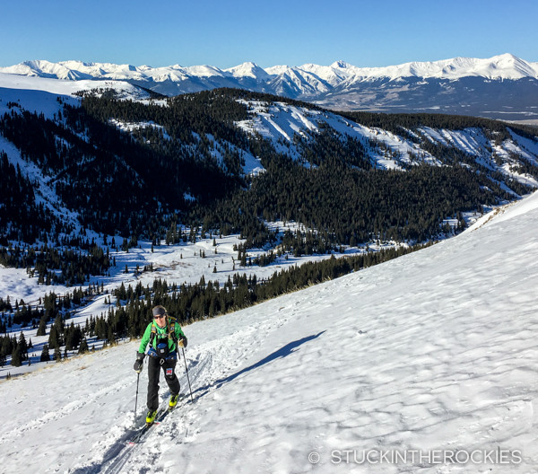
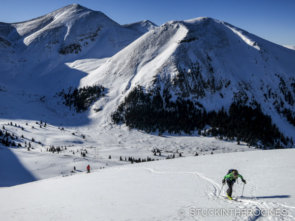
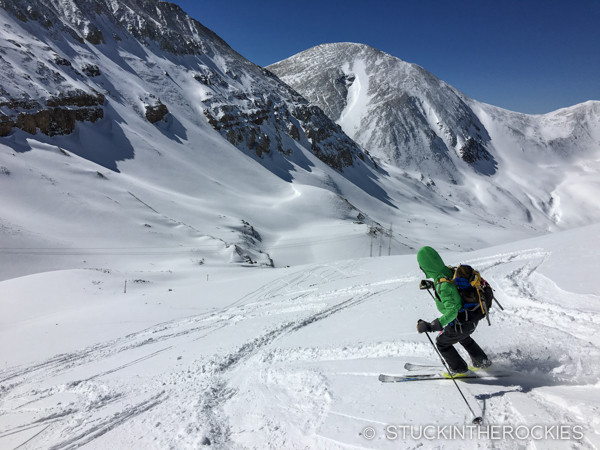
After descending from Ball Mountain, we made our way up the valley and began the climb up East Ball Mountain. Mount Elbert and some other Sawatch summits could be seen out in the distance.
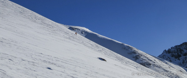
A skier descends East Ball as we climb up towards the summit. Snow conditions were pretty ideal.
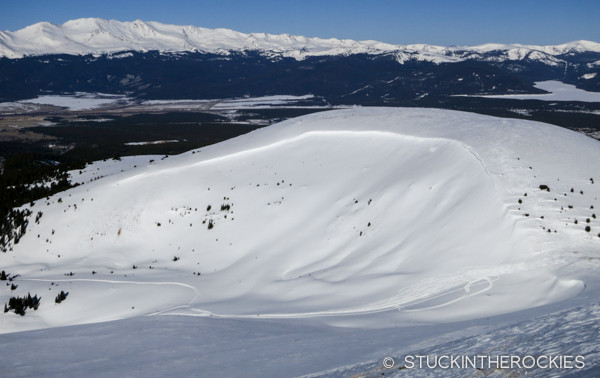
The transition was on the west summit of East Ball Mountain. From the transition point we could look back to Ball Mountain and see the ski descent route and two tiny racers heading down.
A casual transition on the East Ball Mountain highpoint.
Race organizers acknowledged that in harsh conditions, which are often encountered in this part of the state, this course might require some changes. But they also kept open the idea that in future years, should conditions and permitting allow, they may consider actually expanding the course, possibly even incorporating the nearby 14er Mount Sherman.
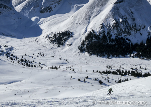
Skiing East Ball down to the Iowa Gulch road.
Looking back up at the skin track and ski line on East Ball Mountain.
A hour later we were on our way up to the summit of Dyer Mountain, 13,855 ft. a Colorado Centennial and the 81st highest peak in the state.
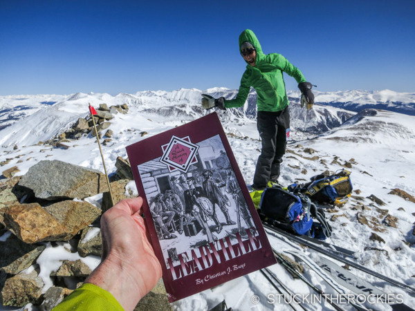
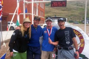
On the summit we had to tear a page from a book to prove we had actually been there. Christy gives a thumbs up before we begin our long descent to the finish. Nice conehead!
It’s always novel to do new things, and the perfect weather contributed to the positive energy around the event, we had an awesome time, both on the course and at the pre and post-race events in town. We’ll definitely be back for this one next year. And that seemed to be the recurring conversation among all of friends at the finish, about seeing everyone next year.
For more info on the race, click here.
Skiing off Dyer, the hulking West Face of Mount Sherman is ahead to our left, and Mount Sheridan can be seen out in the distance.
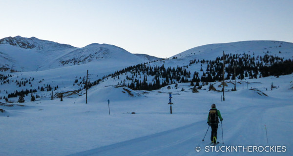
And then it was a long schuss back to the finish at the CMC in Leadville. If there was one minor complaint from the racers it was that the start and finish to and from Leadville was fairly flat and involved a fair amount of groomed nordic trails. We didn’t view it unfavorably, and appreciated the quick egress to the finish.
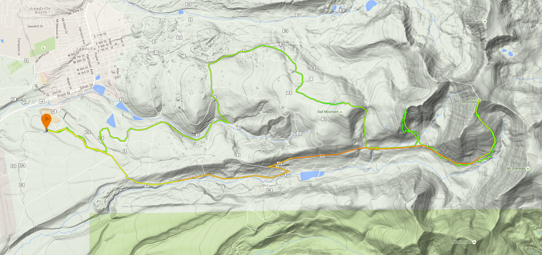
My GPS track of the course, it ran clockwise from the start/finish at the left. Click to enlarge.


1 Comment
Leave your reply.