Exploring the high-visibility ski lines around the Roaring Fork Valley
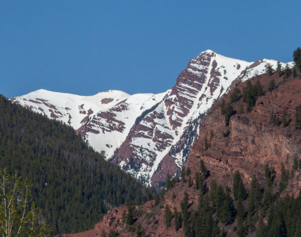
If you’re in need of ideas for outdoor adventures, sometimes it’s helpful to start with what we can see every day in our backyard. It works great for backcountry skiing objectives — looking around the mountains and identifying interesting summits or couloirs is often how ski plans are conceived.
Here in the Roaring Fork Valley, we’re surrounded by highly visible and enticing local ski lines. One look up at a snow-covered Mount Sopris is all it takes to find yourself wondering what it would be like to ski down its slopes. Anyone who has skied Hayden would probably admit their interest arose after years of staring at it from the top of Aspen Mountain or Highlands.
If you’ve ever looked up the Maroon Creek Valley from the base of Aspen Highlands, you might have noticed a thin couloir that descends from near the Snowmass ski area down to Willow Creek. It’s known to some as the Rat Tail Couloir, and while it may not command as much attention as some other more prominent peaks, it’s every bit as worthy.
And by one measure, it’s considerably more challenging.
Like many local skiers, veteran Snowmass ski patrollers Nick Springstead and Wes Reynolds had been looking at the line from afar for years. Eventually, their curiosity got the best of them, and in 2015 they finally decided to give the couloir a closer look on skis.
Before heading out, they needed to do a little homework. They started by inquiring with co-workers at Snowmass Ski Patrol. The seasoned team there had named all of the nearby runs in the West Willow area and were well-versed in the history of local ski descents. So they figured if someone knew about the couloir, it would be them.
According to Springstead, the old guard at Snowmass Patrol was unaware of anyone who had skied it. Not only that, they didn’t even know if it had a name.
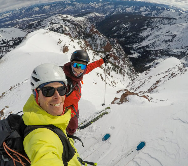
During their research, they learned one important fact: the couloir was interrupted by an impassable cliff of unknown height near the bottom. A continuous descent was likely impossible, which explained the dearth of documented ski history. A rappel would be required to make it to the valley floor.
After gathering that information in the spring of 2015, they made their way from the Snowmass Ski Area to the couloir via Mount Baldy. As Springstead recollected: “We played rock-paper-scissors at the top to see who would ski first. Wes won and dropped in. When we got to the bench at the top of the cliff, we had brought a rope, but it was hard to tell how far it was, so we just elected to climb back up.”
Better safe than sorry. Rather than blindly rappel into an unknown situation, they opted for a more conservative exit.
With the line skied, the next thing to do was give it a proper name. Wes suggested the couloir be called “the Rat Tail.”
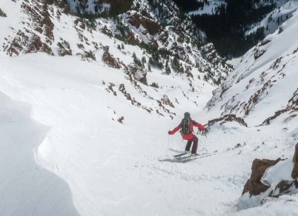
He thought it had a nice ring to it. And seeing as it was a long, thin couloir that descended from a mountain feature called Baldy, the Rat Tail seemed like a relevant play off the hairstyle.
Several years later, in 2019, my friend Pete Gaston reached out to ask if I wanted to ski the Rat Tail. Not only had the name caught on among the community, but we had additional details about the rappel.
Pete informed me that a couple of our friends had skied it earlier in the week and that they set up a snow anchor— known as a deadman— that enabled them to rig a rope and rappel down through the cliffs.
A deadman is a generic term for a buried object in the snow that can support a person’s weight and work as an anchor for climbing purposes. In this case, our friends before us buried a small two-by-four with a loop of cord tied through it.
Aware that the rappel anchor was in place, Pete and I headed out to the Rat Tail. We took the lifts to the top of the Cirque and skinned up towards Mount Baldy. We followed the ridge around to the entrance of the couloir.
It was pretty steep and narrow at the top, similar in look and feel to other couloirs in this area of the Elk Mountains. From the top we couldn’t quite make out where the skiing ended — the snow looked to be continuous for a long way. We put on our harnesses and got ready to ski.
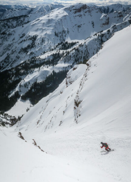
The starting elevation of the couloir was near 12,800 feet, and we descended the east-facing route one at a time, periodically pulling off to the high side to get out of the way of any sluffing snow. We leapfrogged each other until we reached the top of the ledge, where we put the skiing on pause, about 1,600 vertical feet below where we started.
From the edge of the snow, we could peer down to the valley bottom below. The drop-off was comprised of a series of rock ledges, much like you encounter when climbing on and around the Maroon Bells. The route was impossible to descend on skis cleanly.
We found the snow anchor our friends had buried a few days before, and we rigged the rope and prepared to rappel. It was a pretty quick descent down through the crux— we lowered ourselves down through the ledges for about 60 feet. Pete opted to do it with his skis on. I put my skis on my backpack and lowered down on foot.
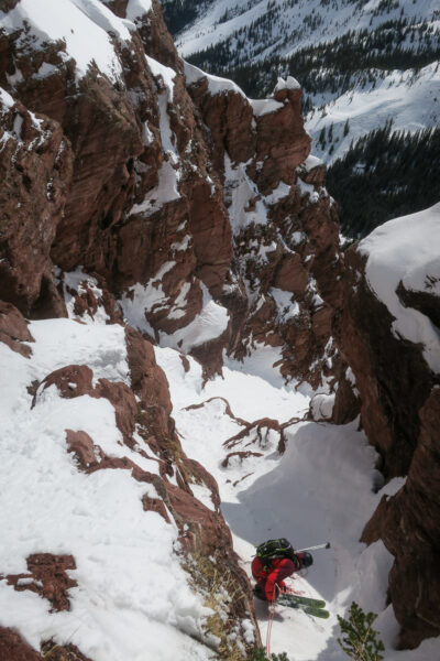
We packed up the rope and got back into ski mode, and we continued down the apron of the couloir. It was full of avalanche debris from slides that likely occurred earlier in the season.
Once down on the valley floor, we descended along the snowy banks of Willow Creek. Then, with the aid of a GPS app, we followed a pre-planned exit route back to the Elk Camp area on Snowmass. It wasn’t long before Pete and I were back in the ski area, making our way home.
A quick look around our valley can provide countless ideas for outdoor adventures. When it comes to backcountry skiing, it can be quite fun to explore the visible lines we see everyday. If you do get an opportunity to ski a route you’ve been eyeing for a while, you’ll never look at that snowy features the same again. As Nick said, it’s fun to look at lines in the valley and say, “I’ve skied down that!”
I couldn’t agree more. And who knows, if it hasn’t been named before and you come up with something clever, it might actually stick.



Leave a Reply