Dry Lakes and Horn Peak
Camp at the first Dry Lake. Continuing with our exploration of the peaks and valleys of the Sangre de Cristo mountains, we headed up to another new area, Dry Lakes and Horn Peak, 13,450 ft. (more…)

Camp at the first Dry Lake. Continuing with our exploration of the peaks and valleys of the Sangre de Cristo mountains, we headed up to another new area, Dry Lakes and Horn Peak, 13,450 ft. (more…)

On the descent from Spread Eagle Peak, looking south towards the heart of the Sangre de Cristos We left town for the holiday weekend and made our way down to the Sangre de Cristo Mountains for a little backpacking and peakbagging. The destination was a place known as Lake of the Clouds, and the goal was to climb two nearby 13ers, Cloud Peak and Spread Eagle Peak. (more…)

Christy heads back to Camp 2 from Ruby Creek, Jagged Peak cuts up the skyline behind. Since Internet readers have notoriously short attention spans I find it’s usually best to keep a post to a few hundred words and maybe ten photos. So when I came home with 1300 photos from our recent Weminuche Traverse through the San Juan Mountains, I thought the single brief post I put up on...

Looking north up the Waterpocket Fold in the morning. As you travel east (right) you pass through younger and younger rock strata. The Waterpocket Fold of Capitol Reef might be best described as a bend in the earth’s crust where subsequent erosion has exposed the underlying rock strata. Whereas the layers of desert rock are normally seen in a canyon wall stacked vertically, the layers of the Fold are tilted...

We decided to check out Capitol Reef National Park last weekend. Like many people, we had long known of this National Park in south central Utah but had never spent any actual time there. One of its major attractions is the Waterpocket Fold, a 100 mile long exposed monocline

On Eureka’s summit, 13,507 ft., looking down to Eureka and Hermit lakes and the Wet Mountain Valley. Continuing with our exploration of the Northern Sangre de Cristos, we backpacked up San Isabel Creek and climbed Eureka Mountain last weekend. Two years ago, Christy and I looked down on San Isabel Lake from the summit of Hermit Peak to the north, and knew we would have to camp there some day...

We tried to stay optimistic, but in the end the weather ruled the day. It’s that time of summer, when the “monsoonal flow” brings regular wet weather to the state. The forecast for last weekend looked less than ideal for any sort of outdoor adventure, but we had made plans to go on a backpacking mission, so we headed out anyway. It’s hard knowing not going, right? The goal was...

Our South Fork Pass camp. It has been unusually hot and very crowded around town, so we decided to escape on a little camping trip last weekend. And whereas we often seek solitude in far away places, we took a chance on a local spot where we’ve always wanted to camp, up by South Fork Pass. (more…)

On the South Ridge of Lakes Peak. As exciting as it can be to see the weather change and a new season arrive, it’s not always easy to let the old one go. Rather than accept it might be time to move on to different sports and activities more appropriate for the conditions, we stubbornly insist on trying to get in one more ski, run, or climb. (more…)

We made another trip into our favorite Colorado wilderness area- the Weminuche, more specifically, Leviathan Lake.
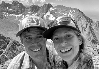
 We met in Aspen in 2000 and have been happily stuck in the rockies ever since, getting out in the mountains every day we can, in every season and by all means possible. Read More
© 2025 · Stuck in the Rockies