Changing scenery to avoid burnout
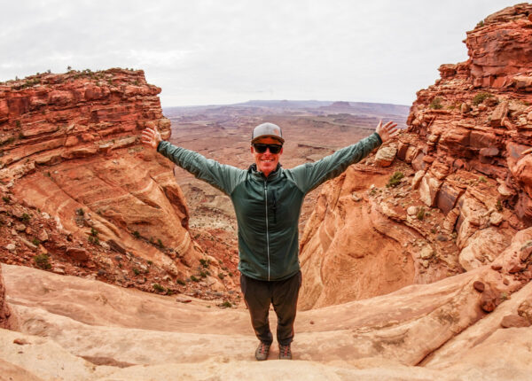
We’re approaching the time of winter when those of us who ski most everyday may start to feel hints of burnout. Sometimes it calls for a few days out of ski boots and a change of scenery a we near the halfway point of the lift-served ski season.
I haven’t felt that way yet for 2021-22, but I know many of us do. And I can certainly look back on years when, by this point, my body and mind needed a break. In those instances, I found a mid-winter trip to the desert to be the perfect remedy.
Snow-free scenery is a quick road trip away in Canyonlands National Park, where I fled this time last year when weather apps showed a continuing period of sunny, high-pressure days around Aspen.
Experience has taught me that the temperatures in the Canyonlands region of Utah are typically 10-15 degrees warmer than what we see here at home. So, after looking at the local forecast for the week ahead, I noted the two warmest days and made plans to get out of town.
My destination was the Island in the Sky District of Canyonlands. My goal was to switch out the ski boots for trail shoes and get out on a few hikes. I also wanted to bring my camera gear and see if I could get some photos of the desert landscape that defines Utah’s national parks.
Wallace Stegner once said the National Parks were America’s best idea. I wholeheartedly agree. But if you’ve ever visited the Utah parks during the standard desert season— spring and fall— you might find them to be so busy it detracts from the experience. Anyone who has driven into Moab can attest to the insane line of cars queued up trying to get into Arches every day (Edward Abbey is credited with coining the “Arches National Parking Lot” moniker).
In mid-winter, it’s an entirely different experience. Parking areas and campgrounds are empty, and overlooks have unobstructed views. Visitation is so low they often don’t even staff the entrance stations. So I knew there was a good chance I would have the place to myself.
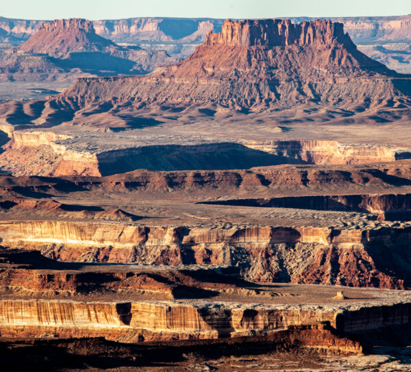
I rummaged through my gear closet in search of car camping items that I needed to keep me comfortable in 50-degree days and 30-degree nights. I organized my camera equipment and hiking gear. I threw it all in the truck along with two bundles of firewood and hit the road.
I timed my departure so I’d reach the BLM campgrounds along the Colorado River near Moab just before dark. In the popular fall months, you don’t stand a chance of pulling in and nabbing one of these campsites without a reservation. In January, they were practically empty.
After picking a secluded site right on the bank of the Colorado River, I got to work on a campfire. I pulled out a camp chair, cracked a beer, and settled in for the evening.
The following day I packed up early and headed to the park entrance. I was dressed and ready for the hike I had in mind on the Murphy Trail. But first, I wanted to stop for some photos.
When it comes to desert photography, timing is everything. If you’re serious about capturing that great shot, morning or evening light is best— avoid the middle of the day.
It’s also wise to do some homework in advance. Desert features often show best at a particular time of day. Due to aspect and positioning, some get the best light in the morning hours. Others, like the famous Delicate Arch, look best at sunset.
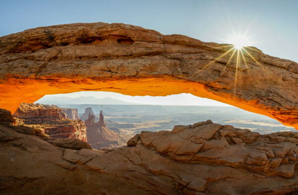
I pulled into the parking area for Mesa Arch with that in mind. If you’re there in the morning, you can capture the sun as it rises just above the arch. It illuminates the White Rim in the valley below and the famous Washer Woman Tower. It’s postcard-worthy and only a short walk from the parking area.
Feeling confident that I captured some good photos, I hopped back in the car and headed to my first hike.
Like many other National Parks, Island in the Sky can feel like a “driving park” where you do a lot of road cruising to the pretty vistas. But if you like to log some time on your feet, there are a lot of great trails and hiking options.
Most of the roads, overlooks, and tourist attractions of Island in the Sky sit atop a mesa. From that perch, it’s possible to descend to the White Rim Road on the shelf below. Lathrop, Wilhite, Gooseberry, and Alcove Springs trails are all routes maintained by park service staff. They’re all several miles in length, and they will lead you down to the White Rim Road, and in some cases, all the way to the Colorado or Green rivers.
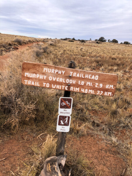
The first hike I embarked on was an out-and-back along the Murphy Trail to the famous hogback that bears its name. It was about eight miles round trip, it took several hours, and I saw exactly one other person.
After the hike, I drove to the only campground in the area— Willow Flats— where I planned to spend the night. I thought it would be good to claim a spot if there were others with the same idea. However, as I drove the loop surveying prospective car campsites, I realized my concerns were not warranted. Nobody else was there.
With a campsite claimed, I set out for an afternoon hike on the Neck Spring Trail. It was eerily quiet along this five-mile loop.
Upon completing the hike, I found myself at the Shafer Trail Overlook— a perch that offers commanding views of the Gooseneck section of the Colorado River framed with the La Sals as a backdrop. Again, my timing was good. Photos from this vantage point are best in the late afternoon with the setting sun at your back.
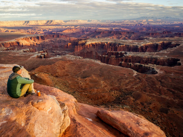
I couldn’t stay long. I needed to make the short drive to the White Rim Overlook to capture the sunset. It’s a spectacular position at the south end of the park. I walked out to the edge of the rim, which might as well have been the edge of the world. The sun slowly set on the White Rim below, and then the La Sal Mountains in the distance. I thought about the day and my plans for the following morning, and before long it was dark and I was sitting at the campfire at Willow Flats campground.
A quiet, starry night at camp was followed by a morning at the Green River Overlook. I fired up my JetBoil, got the French Press ready, walked to the overlook, and set up my camera and tripod. This location has impressive panoramic views to the southwest— of the Turk’s Head, Cleopatra’s Chair and the sandstone buttes of the Maze District.
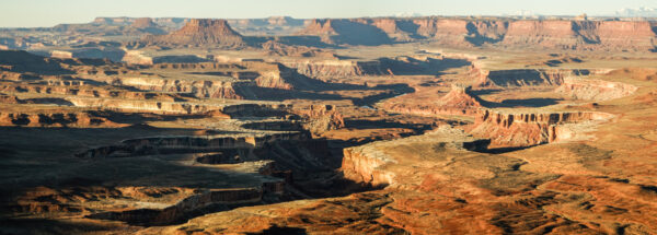
I wrapped up the photo and coffee session and headed over to the Syncline Trail. It’s another eight-mile hiking route around a massive geologic feature known as the Upheaval Dome. Again, it was a beautiful hike that had moments where it felt like I was pretty far out there on my own.
After completing the loop, I made the short hike to the Upheaval Dome Overlook, where you can see this unusual crater-like desert formation. It came as no surprise that I only saw a few people.
And then it was time to head home. Two days and two nights of car camping and desert hiking were all it took to feel refreshed and ready to be on skis again. While the quick break didn’t help me get my 100-day pin any faster, the change of scenery and quiet time was just what I needed.




Leave a Reply