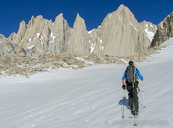
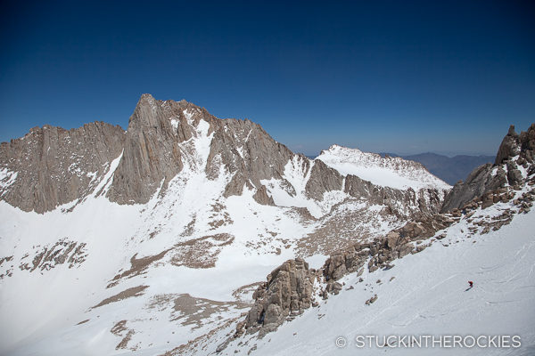
Approaching the East Face of Mount Whitney. The summit is the high point in the photo, the Mountaineer’s Route is to the right of the summit.
Being a couple of Colorado ski mountaineers we’ve always had a thing for 14ers. There are so many in our backyard it’s hard not to hold a special place for them. So when we arrived to California’s Eastern Sierras, home to some of California’s dozen or so 14,000 foot peaks, it was natural that we would want to spend a little time getting to know a few of them. And the obvious choice for the visiting ski mountaineer is Mount Whitney.
At 14,508 ft. Mount Whitney isn’t just the high point of the Sierra Nevada Mountains, it’s the tallest summit in the lower 48 (yes, taller than Mount Rainier and everything in Colorado). Despite its commanding elevation, it offers a wide variety of options for climbing. If you want a straightforward hike, the Mount Whitney Trail is the most popular route. If you want to take on more challenge, Whitney’s east facing granite walls offer dozens of technical options. And if you’re a ski mountaineer, you have the Mountaineer’s Route.
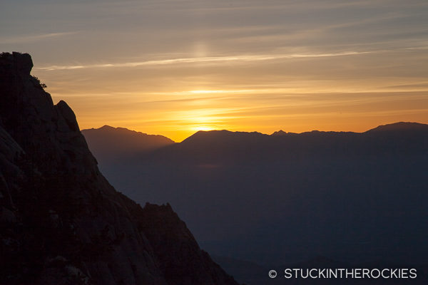
California 14er trailheads are always quite low in elevation and alpine starts are common. The silver lining: you’ll catch a cool sunrise.
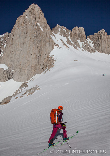
Once onto the snow we walked a bit up the creek until we reached Lower Boy Scout Lake, which is where we switched to skins and skis.
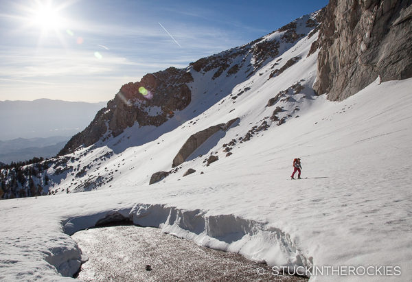
Finally, with skis on the snow, near a gaping melted patch where the free-flowing water flows over granite.
This aptly named route is a bucket-list objective for mountaineers and 14er skiers. The moderately steep couloir ascends to the south of the summit and its east-facing technical routes, and can be clearly seen from the town of Lone Pine and Highway 395, some 10,000 feet down in the valley below! It isn’t an aesthetically perfect couloir in that it doesn’t top out right at the summit, but if you’re looking for a ski route on this mountain, this is where to head.
From the top of the couloir you’ll have to climb and/or traverse one of several north-facing gullies to reach the broad summit plateau. The gullies nearest the top of the couloir are the steepest and most direct and have some 5th class climbing. The further across the north face you traverse, the more the angle and difficulty of the gullies eases. But depending on the conditions, traversing further to get to them can be challenging in itself. You should decide when you get there and can assess the options better, but whichever route you choose, reaching this lofty summit is well worth the effort.
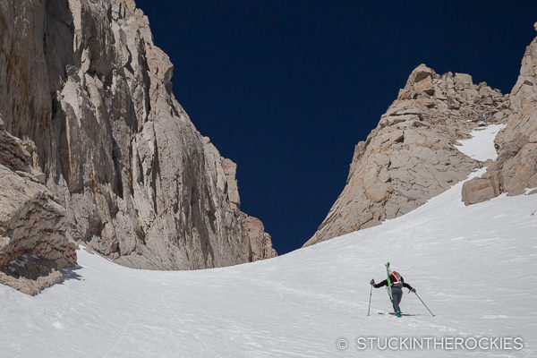
Nearing Iceberg Lake and the base of the Mountaineer’s Route on Mount Whitney.
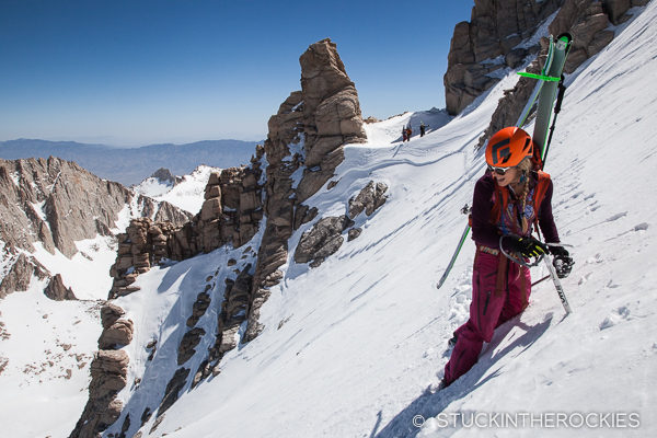
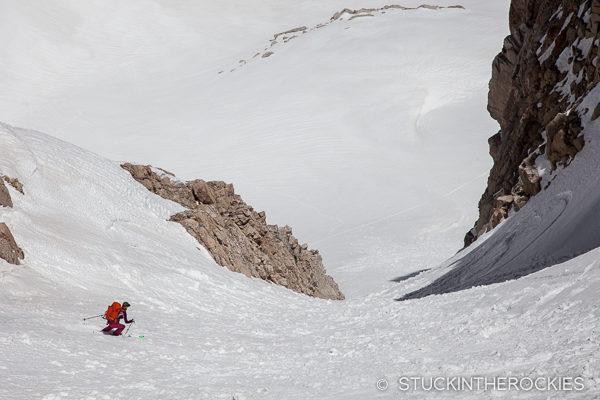
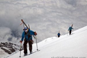
Skins worked most of the way up the couloir for us.
Eventually you’ll switch to booting.
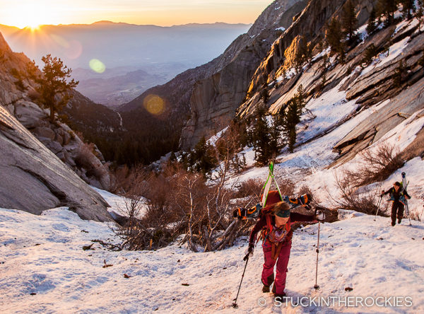
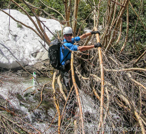
From a start at the Whitney Portal (~8300 ft.) follow the Mount Whitney trail for a little less than a mile to a signed fork for the North Fork of Lone Pine Creek. Leave the main trail here and follow the more faint North Fork of Lone Pine Creek trail until you reach snow. For us, in early May of a banner snow year, that was barely a quarter of a mile. That’s where the trail crossed the creek itself, in a mess of trees and vegetation that in hindsight was one of the cruxes of the day. Once across the creek we were on snow and had an easier time ascending.
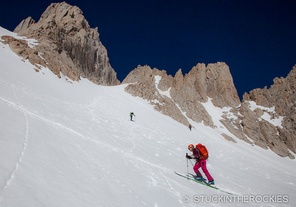
We hiked a bit and then skinned up past Lower Boy Scout Lake, Frog Pond, and Iceberg Lake, which was right at the base of the couloir. Skin or boot the couloir to its top and assess the options. We decided to traverse to a lower angle gully.
Mid-traverse, the top of the Mountaineer’s Route couloir is in the notch behind. The traverse felt more more exposed than the photo indicates. The slopes below are steep and end in a cliff, and on sections where the snow was firm the front point traversing was somewhat gripping. On other years we’re told it can be less snow covered. Is that easier?
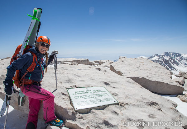
On the summit – the plaque commemorating the terminus of the John Muir Trail.
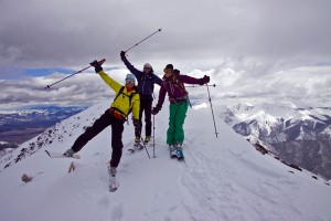
Whichever way you choose, make your way to the broad summit plateau and walk or skin across the talus to the summit, the highest point in the lower 48. Congrats!
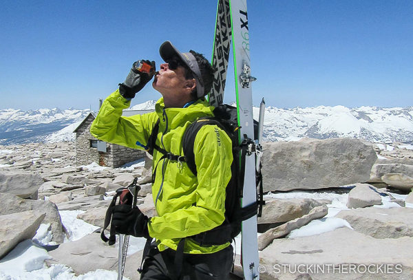
A wee nip of some celebratory bourbon from a new friend we met on the way up.
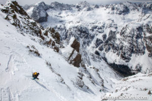
For skiing, it’s obviously possible to retrace your route of ascent, or if you want a slightly different route down you can ski the north face to the saddle between Whitney and Mount Russell and look for a small couloir that will take you down to Upper Boy Scout Lake. I’m not going to specify details on that here, but if you’re interested, a little Google Earth research should help you find the way.
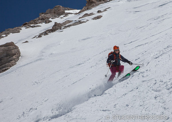
Skiing the North Face down to the Whitney – Russell col.
A bit further down.
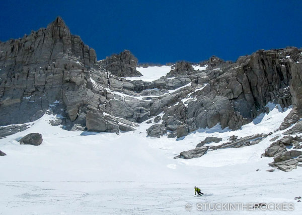
That’s Mount Russell behind.
Descending to Upper Boy Scout Lake.
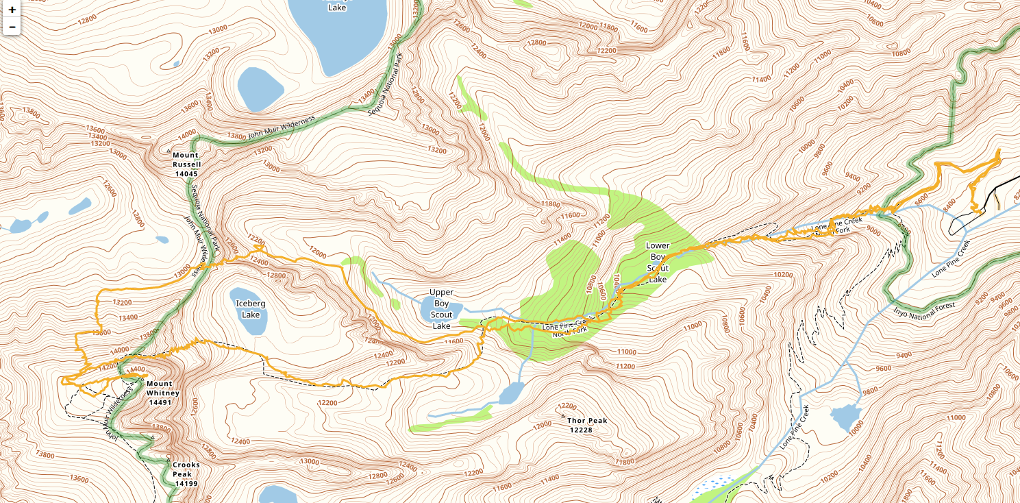
A route overview. Click to enlarge.
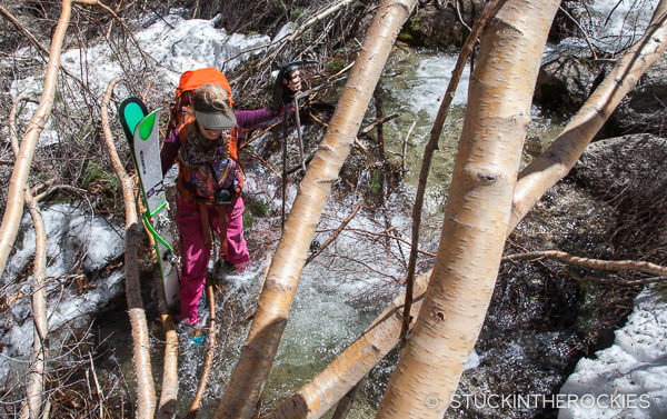
And then returning through the crux of the day, the creek crossing.
My ski toss didn’t go so well.
Enjoy it, Mount Whitney is a classic!


3 Comments
Leave your reply.