
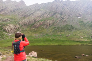
As I’ve said before, the Weminuche Wilderness is our favorite place in the state. It’s wild, tough to access, and has so many peaks to climb that you could make a backpacking trip there once a summer for 20 years, and it still might not be enough time to tackle all the high summits.
What also keeps us going back is that when you’re there and on a peak, it’s impossible not to look around and see other super-cool peaks you want to visit next.
On several trips to the Weminuche, Christy and I have found ourselves looking at the trio of 13ers that stands north across the valley from Pigeon and Turret peaks.
This trio– Monitor Peak, Peak Thirteen, and Animas Mountain– comprises a massif that is worthy of a trip in itself. We first passed near them on a 2006 trip to Ruby Creek when I was finishing the Centennials with climbs of Jagged, Pigeon, and Turret.
On subsequent trips nearby, we would always look over at the group in awe and tell ourselves, “someday.”
We were back in Upper Ruby Creek during our Weminuche Traverse in 2014, and then again on Pigeon and Turret in 2015 as we finished skiing the Centennials.
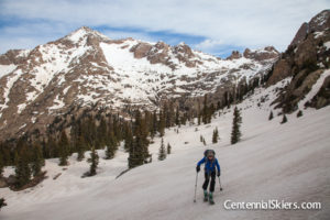
Ruby Creek Approach
This year, we decided we needed to climb them. We hopped on the train to Needleton and started up the Ruby Creek Trail.
With the increased popularity of climbing peaks and the growing number of backcountry travelers, we assumed the trail would be easier to follow than it was on our initial visit here.

We were wrong. If anything, the trail seemed more overgrown. The spruce beetle infestation that swept through the San Juans resulted in widespread tree death, and the resulting deadfall made the day even more arduous.
My advice for anyone heading up the Ruby Creek Trail is to follow the guidebook directions from Roach and others, but always be mindful of your surroundings and consider your location and destination. Some of the info (“pass a downed tree and look for a faint trail…”) is dated and no longer accurate.
Unfortunately, I’m unable to contribute a proper GPX track because we often found ourselves doubling back and going full cross-country at times, which disqualifies me from giving anyone directions!
Other parties would prefer to get to Ruby Creek via Twin Thumbs Pass or Noname Creek. If you have the time, those are reasonable options.

Once you get to Upper Ruby Creek, however you go, you will be rewarded. It’s an amazing place.
Climbing the Peaks
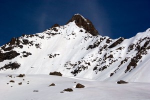
As for our trip, after the brutal approach, we set up camp and got ready for the peaks the next morning. We made our way up into the large, south-facing basin below the three 13ers and headed in the direction of Monitor Peak.

There was an easy, broad ledge that traversed below Peak Thirteen that led us to the base of Monitor. From there, it was some semi-solid Class 3-4 up to the summit. We opted to have a short rope ready after reading some trip reports that advised the gear. Truth be told, it wasn’t that hard, and we found it unnecessary. However, we did need it later in the day, so we were glad we had it.

From the summit of Monitor Peak – 13,707 ft., we had an unbelievable view. There are too many noteworthy peaks to name. We were surrounded.

A short descent down to the Monitor-Peak Thirteen saddle, and we were once again scrambling up some Class 3 or easy Class 4 moves to the summit of Peak Thirteen.
Peak Thirteen, 13,725 ft., isn’t a ranked summit, but if you’re doing Monitor and Animas, then going over the summit of Thirteen makes practical sense.

As we descended from Peak Thirteen towards Animas Mountain, we found ourselves in a steep, exposed section with some old, tattered slings around a chockstone. That always serves as a good indicator that 1. you’re on the route, and 2. that you, too, might want to rig a rope for a rappel.

So rappel we did. After that brief technical section, the terrain remained friendly until the final summit block of Animas Mountain. Once again, we found that a few short technical moves were needed to reach the summit. Most people would be fine without a rope, but some may prefer one.
The summit of Animas Mountain – 13,786 ft., like the others, was a really cool perch. We took in the views, which were obscured by wildfire smoke that had moved in from a nearby fire to the west, unfortunately.

We didn’t stay up top for long; we had to descend to camp and then pack up and make our way over to Upper Noname Creek. We had some other peaks to tackle the following morning!


Leave a Reply